IMAGES TAKEN NEAR TO
Linley, BISHOPS CASTLE, SY9 5HW
Introduction
This page details the photographs taken nearby to SY9 5HW by members of the Geograph project.
The Geograph project started in 2005 with the aim of publishing, organising and preserving representative images for every square kilometre of Great Britain, Ireland and the Isle of Man.

There are currently over 7.5m images from over14,400 individuals and you can help contribute to the project by visiting https://www.geograph.org.uk
Image Map
Images are licensed for reuse under creativecommons.org/licenses/by-sa/2.0
Notes
- Clicking on the map will re-center to the selected point.
- The higher the marker number, the further away the image location is from the centre of the postcode.
Image Listing (15 Images Found)
Images are licensed for reuse under creativecommons.org/licenses/by-sa/2.0
Image
Details
Distance
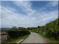
1
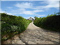
Access track to Squire Hall farm near Linley
A narrow lane.
Image: © Jeremy Bolwell
Taken: 7 May 2020
0.05 miles
2
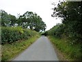
Lane to Linley
Near Squire Hall.
Image: © Christine Johnstone
Taken: 7 Aug 2011
0.05 miles
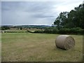
3
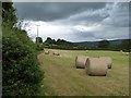
Swiss rolls under a stormy sky
The hedge on the left separates the field from the lane.
Image: © Christine Johnstone
Taken: 7 Aug 2011
0.05 miles
4
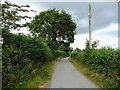
Lane to Norbury
Near Squire Hall.
Image: © Christine Johnstone
Taken: 7 Aug 2011
0.05 miles
5
Shropshire Swiss roll
Off the hills and on the flat valley bottom.
Image: © Christine Johnstone
Taken: 7 Aug 2011
0.07 miles
6
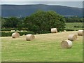
Shropshire Swiss rolls
The Long Mynd fills the horizon.
Image: © Christine Johnstone
Taken: 7 Aug 2011
0.08 miles
7
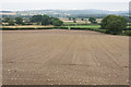
Planted field near Squire Hall Farm
Looking towards the valley of the Onny.
Image: © Bill Boaden
Taken: 18 Aug 2018
0.10 miles
8
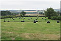
Silage bales for collection
Farmland in the valley of the Onny.
Image: © Bill Boaden
Taken: 18 Aug 2018
0.12 miles
9
On the lane between Norbury and Linley, Shropshire
A typical narrow rural lane between villages.
Image: © Jeremy Bolwell
Taken: 7 May 2020
0.13 miles
10
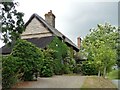
Thatched cottage, Linley
Just east of the bottom of Arbour Lane.
Image: © Christine Johnstone
Taken: 7 Aug 2011
0.20 miles