IMAGES TAKEN NEAR TO
Coreley, LUDLOW, SY8 3AW
Introduction
This page details the photographs taken nearby to SY8 3AW by members of the Geograph project.
The Geograph project started in 2005 with the aim of publishing, organising and preserving representative images for every square kilometre of Great Britain, Ireland and the Isle of Man.

There are currently over 7.5m images from over14,400 individuals and you can help contribute to the project by visiting https://www.geograph.org.uk
Image Map (Loading...)


Getting Data...Please wait
Leaflet Map data © OpenStreetMap
Images are licensed for reuse under creativecommons.org/licenses/by-sa/2.0
Notes
- Clicking on the map will re-center to the selected point.
- The higher the marker number, the further away the image location is from the centre of the postcode.
Image Listing (8 Images Found)
Images are licensed for reuse under creativecommons.org/licenses/by-sa/2.0
Image
Details
Distance
1
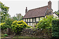
Brookrow Cottage
17th Century grade II listed cottage - see www.historicengland.org.uk/listing/the-list/list-entry/1383710.
Image: © Ian Capper
Taken: 6 Aug 2020
0.03 miles
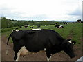
4
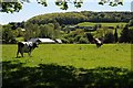
Dairy cattle in a field
A pair of Holstein Friesian cattle in a field near Brookrow to the south of Hints.
Image: © Philip Halling
Taken: 14 May 2018
0.07 miles
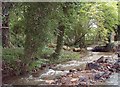
7
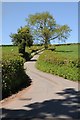
The road to Hints
Country road from Coreley to Hints.
Image: © Philip Halling
Taken: 14 May 2018
0.17 miles
8
Knowle, cows
Looking impatient for milking time.
Image: © Mike Faherty
Taken: 14 May 2011
0.20 miles