IMAGES TAKEN NEAR TO
Mayfields, LUDLOW, SY8 2QB
Introduction
This page details the photographs taken nearby to Mayfields, SY8 2QB by members of the Geograph project.
The Geograph project started in 2005 with the aim of publishing, organising and preserving representative images for every square kilometre of Great Britain, Ireland and the Isle of Man.

There are currently over 7.5m images from over14,400 individuals and you can help contribute to the project by visiting https://www.geograph.org.uk
Image Map (Loading...)


Getting Data...Please wait
Leaflet Map data © OpenStreetMap
Images are licensed for reuse under creativecommons.org/licenses/by-sa/2.0
Notes
- Clicking on the map will re-center to the selected point.
- The higher the marker number, the further away the image location is from the centre of the postcode.
Image Listing (48 Images Found)
Images are licensed for reuse under creativecommons.org/licenses/by-sa/2.0
Image
Details
Distance
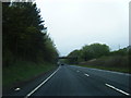
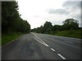
2
A49 - lane overbridge north of Ludlow
Image: © Peter Whatley
Taken: 16 Aug 2011
0.04 miles
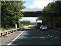
3
A49 crossed by Fishmore Road overbridge
Image: © Stuart Logan
Taken: 21 Sep 2013
0.06 miles
4
Layby on the northbound A49 (Ludlow bypass)
Image: © Peter Whatley
Taken: 6 Jul 2013
0.07 miles
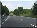
6
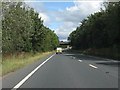
A49 approaching the lane overbridge north of Ludlow
Image: © Peter Whatley
Taken: 16 Aug 2011
0.07 miles
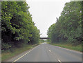
7
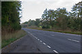
A49 Ludlow bypass
Opened in 1979, relieving the Ludlow from heavy north south traffic totally unsuited to the town. In the background is the bridge carrying Fishmore Road over the bypass.
Image: © Ian Capper
Taken: 16 Oct 2011
0.08 miles
8
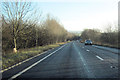
A49 Ludlow By pass southbound
Approaching overbridge which can be seen in the distance
Image: © John Firth
Taken: 22 Dec 2011
0.08 miles
9
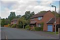
Stanton Road
Stanton Road runs from Fishmore Road before connecting into Weyman Road off Henley Road. Development started in the 1970s and continued as a fill in up to the 1979 built Ludlow bypass.
Image: © Ian Capper
Taken: 16 Oct 2011
0.09 miles
10
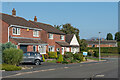
Fishmore View
c.1980s housing on a cul-de-sac off Fishmore Road. In the distance can be seen Titterstone Clee Hill. This first section was on the site of a former timber yard and saw mill.
Image: © Ian Capper
Taken: 20 Sep 2020
0.11 miles