IMAGES TAKEN NEAR TO
Summerfields, LUDLOW, SY8 2QA
Introduction
This page details the photographs taken nearby to Summerfields, SY8 2QA by members of the Geograph project.
The Geograph project started in 2005 with the aim of publishing, organising and preserving representative images for every square kilometre of Great Britain, Ireland and the Isle of Man.

There are currently over 7.5m images from over14,400 individuals and you can help contribute to the project by visiting https://www.geograph.org.uk
Image Map
Images are licensed for reuse under creativecommons.org/licenses/by-sa/2.0
Notes
- Clicking on the map will re-center to the selected point.
- The higher the marker number, the further away the image location is from the centre of the postcode.
Image Listing (38 Images Found)
Images are licensed for reuse under creativecommons.org/licenses/by-sa/2.0
Image
Details
Distance
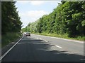
1
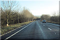
A49 Ludlow By pass southbound
Approaching overbridge which can be seen in the distance
Image: © John Firth
Taken: 22 Dec 2011
0.02 miles
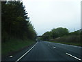
2
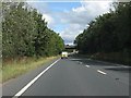
A49 approaching the lane overbridge north of Ludlow
Image: © Peter Whatley
Taken: 16 Aug 2011
0.02 miles
3
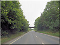
A49 crossed by Fishmore Road overbridge
Image: © Stuart Logan
Taken: 21 Sep 2013
0.04 miles
4
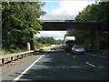
A49 - lane overbridge north of Ludlow
Image: © Peter Whatley
Taken: 16 Aug 2011
0.06 miles
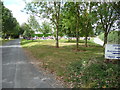
5
Ludlow bypass immediately west of Fishmore Road bridge
Image: © Peter Whatley
Taken: 6 Jul 2013
0.07 miles
7
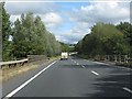
A49 - River Corve bridge
Bags of room for a dual carriageway, so why wasn't one built?
Image: © Peter Whatley
Taken: 16 Aug 2011
0.11 miles
8
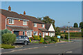
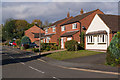
Fishmore View
c.1980s housing on a cul-de-sac off Fishmore Road. In the distance can be seen Titterstone Clee Hill. This first section was on the site of a former timber yard and saw mill.
Image: © Ian Capper
Taken: 20 Sep 2020
0.12 miles
9
Fishmore View
1980s development off Fishmore Road, on the site of a former timber yard/sawmill and, beyond, the route of the former Cleehill branch railway.
Image: © Ian Capper
Taken: 16 Oct 2011
0.12 miles
10
Walkers on the 2011 Magnalonga rest near Ludlow
The Magnalonga is an idea borrowed from Italy and is part of the Slow Food movement whereby walkers pay to walk through the countryside around Ludlow sampling the produce of a wide range of local food producers. The aim is to promote local produce, local markets and high quality food and drink as an alternative to mass market supermarkets, unenlightened consumption, unseasonality, bogof deals and the 'pile it high sell it cheap' retailing that often prevails, with all the associated food miles, battery farming and poor diets and ill health that causes concern to many.
Here walkers can decide for themselves if local producers can better what the supermarkets offer both in terms of quality, freshness, variety, choice and value for money, while enjoying music en route, good company and good weather.
Image: © Jeremy Bolwell
Taken: 14 Aug 2011
0.12 miles