IMAGES TAKEN NEAR TO
Worthen, SHREWSBURY, SY5 9JP
Introduction
This page details the photographs taken nearby to SY5 9JP by members of the Geograph project.
The Geograph project started in 2005 with the aim of publishing, organising and preserving representative images for every square kilometre of Great Britain, Ireland and the Isle of Man.

There are currently over 7.5m images from over14,400 individuals and you can help contribute to the project by visiting https://www.geograph.org.uk
Image Map
Images are licensed for reuse under creativecommons.org/licenses/by-sa/2.0
Notes
- Clicking on the map will re-center to the selected point.
- The higher the marker number, the further away the image location is from the centre of the postcode.
Image Listing (16 Images Found)
Images are licensed for reuse under creativecommons.org/licenses/by-sa/2.0
Image
Details
Distance
1
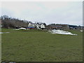
Hamptonhayes Farm
A south-facing sheep farm on the slopes of Aston Hill.
Image: © Richard Law
Taken: 1 Apr 2013
0.01 miles
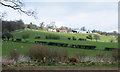
3
View to Hamptonhayes farm
Nice isolated upland farm.
Image: © Jeremy Bolwell
Taken: 2 Jun 2019
0.02 miles
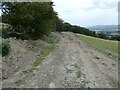
4
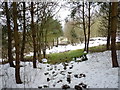
Bridleway down to Hamptonhayes Farm
The rather damp track runs down through a small plantation to Hamptonhayes.
Image: © Richard Law
Taken: 1 Apr 2013
0.04 miles
5
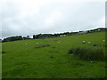
Looking up the sheep pasture towards Hamptonhayes farm
A steepish path takes us up there.
Image: © Jeremy Bolwell
Taken: 2 Jun 2019
0.07 miles
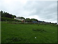
6
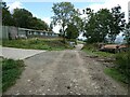
Approaching Hamptonhayes
Some farm buildings to walk by.
Image: © Jeremy Bolwell
Taken: 29 Aug 2024
0.08 miles
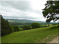
8
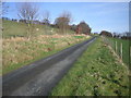
View from a lane below Hamptonhayes
Lovely views.
Image: © Jeremy Bolwell
Taken: 29 Aug 2024
0.13 miles
10
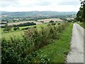
View from a field track way above Brockton and Worthen
Looking towards the lovely hills like Bromlow Callow.
Image: © Jeremy Bolwell
Taken: 2 Jun 2019
0.13 miles