1
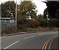
Aston Road bus stop, Wem
The bus stop sign is on a lamppost, between Wem railway station
behind the camera and Orchard Way http://www.geograph.org.uk/photo/4195516 ahead.
Image: © Jaggery
Taken: 5 Oct 2014
0.05 miles
2
Western branch of Cordwell Park, Wem
Houses on the west side of the main north-south course of Cordwell Park.
Image: © Jaggery
Taken: 5 Oct 2014
0.06 miles
3
Southern end of Cordwell Park, Wem
Viewed across Aston Road. A sign shows HOME ZONE and a 20mph speed limit through Cordwell Park.
Image: © Jaggery
Taken: 5 Oct 2014
0.06 miles
4
Aston Road, Wem
Viewed from the Orchard Way junction looking past the left turn for Prince William Court.
Image: © Jaggery
Taken: 5 Oct 2014
0.06 miles
5
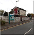
Kissing gate on a corner in Wem
On the corner of Orchard Way and Aston Road. A signpost shows Public Footpath to Leek Street.
A notice on the kissing gate shows ACCESS ONLY TO FOOTBRIDGE.
Image: © Jaggery
Taken: 5 Oct 2014
0.06 miles
6
3-storey block of flats, Cordwell Park, Wem
On the east side of Cordwell Park, near the Aston Road junction.
Image: © Jaggery
Taken: 5 Oct 2014
0.07 miles
7
STOP when lights show, Aston Road, Wem
The sign is on the approach to this http://www.geograph.org.uk/photo/4236121 level crossing at the northern edge of Wem station.
Image: © Jaggery
Taken: 5 Oct 2014
0.07 miles
8
Wem level crossing
The road crosses the Welsh Marches Line at the NE end of Wem railway station.
Ahead are Soulton Road to the left and Aston Road to the right.
Image: © Jaggery
Taken: 5 Oct 2014
0.07 miles
9
Level crossing enforcement cameras sign, Wem
Alongside Aston Road on the approach to this http://www.geograph.org.uk/photo/4236121 level crossing.
Image: © Jaggery
Taken: 5 Oct 2014
0.07 miles
10
Houses on Aston Road from railway
Image: © John Firth
Taken: 18 Aug 2011
0.07 miles


