IMAGES TAKEN NEAR TO
Wytheford, Shawbury, SHREWSBURY, SY4 4JJ
Introduction
This page details the photographs taken nearby to SY4 4JJ by members of the Geograph project.
The Geograph project started in 2005 with the aim of publishing, organising and preserving representative images for every square kilometre of Great Britain, Ireland and the Isle of Man.

There are currently over 7.5m images from over14,400 individuals and you can help contribute to the project by visiting https://www.geograph.org.uk
Image Map
Images are licensed for reuse under creativecommons.org/licenses/by-sa/2.0
Notes
- Clicking on the map will re-center to the selected point.
- The higher the marker number, the further away the image location is from the centre of the postcode.
Image Listing (7 Images Found)
Images are licensed for reuse under creativecommons.org/licenses/by-sa/2.0
Image
Details
Distance
3

Old Direction Sign - Signpost by the B5063, Great Wytheford, Childs Ercall Parish
Annulus finial - 3 Worboys arms; Shropshire CC modern halo by the UC road, in parish of Childs Ercall (North Shropshire District), Great Wytheford.
Surveyed
Milestone Society National ID: SA_SJ5718
Image: © Milestone Society
Taken: Unknown
0.14 miles
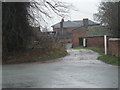
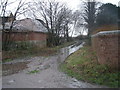
4
Grass triangle
Road junction by Great Wytheford.
Image: © Richard Webb
Taken: 25 Jul 2015
0.15 miles

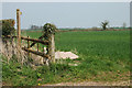
7
Short Path
This footpath ends at the road somewhere near to the passing lorry.
Image: © Michael Patterson
Taken: 20 Feb 2007
0.25 miles