IMAGES TAKEN NEAR TO
Lowfield, SHREWSBURY, SY2 5XT
Introduction
This page details the photographs taken nearby to Lowfield, SY2 5XT by members of the Geograph project.
The Geograph project started in 2005 with the aim of publishing, organising and preserving representative images for every square kilometre of Great Britain, Ireland and the Isle of Man.

There are currently over 7.5m images from over14,400 individuals and you can help contribute to the project by visiting https://www.geograph.org.uk
Image Map
Images are licensed for reuse under creativecommons.org/licenses/by-sa/2.0
Notes
- Clicking on the map will re-center to the selected point.
- The higher the marker number, the further away the image location is from the centre of the postcode.
Image Listing (28 Images Found)
Images are licensed for reuse under creativecommons.org/licenses/by-sa/2.0
Image
Details
Distance
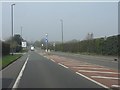
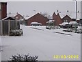
7
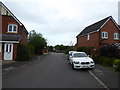
Part of Oswell Road, Underdale, Shrewsbury
Modern housing estate.
Image: © Jeremy Bolwell
Taken: 24 May 2019
0.14 miles
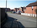
10
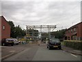
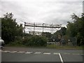
Removing the Overhead Cables
At last the overhead cables have been removed from over these houses
Image: © Mr M Evison
Taken: 18 Jun 2011
0.15 miles