IMAGES TAKEN NEAR TO
Monkmoor Road, SHREWSBURY, SY2 5AS
Introduction
This page details the photographs taken nearby to Monkmoor Road, SY2 5AS by members of the Geograph project.
The Geograph project started in 2005 with the aim of publishing, organising and preserving representative images for every square kilometre of Great Britain, Ireland and the Isle of Man.

There are currently over 7.5m images from over14,400 individuals and you can help contribute to the project by visiting https://www.geograph.org.uk
Image Map
Images are licensed for reuse under creativecommons.org/licenses/by-sa/2.0
Notes
- Clicking on the map will re-center to the selected point.
- The higher the marker number, the further away the image location is from the centre of the postcode.
Image Listing (151 Images Found)
Images are licensed for reuse under creativecommons.org/licenses/by-sa/2.0
Image
Details
Distance
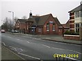
1
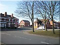
Racecourse Avenue/Crowmere Road/Monkmoor Road Junction
Image: © Mr M Evison
Taken: 7 Mar 2010
0.02 miles
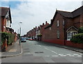
2
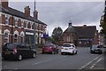
Crowmere Road, Shrewsbury
An densely populated area with many brick terraces.
Image: © Richard Webb
Taken: 11 Oct 2017
0.03 miles
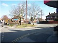
4
Crowmere Road, Shrewsbury
One of several streets with brick terraces off Monkmoor Road.
Image: © Richard Webb
Taken: 11 Oct 2017
0.05 miles
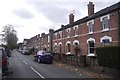
5
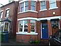
69, Monkmoor Road, Monkmoor, Shrewsbury with its blue plaque for Wilfred Owen
Wilfred Owen moved here with his family when he was 17 years of age and wrote some of his early poems here. The famous blue plaque system commemorates this.
It must be somewhat a pain for the current residents who are, I am sure, just trying to occupy their home normally when people like me rock up and snap away...
I am hopeful that like me, they have been moved by his poems and can understand. Owen was perhaps the greatest poet of the Great War...
Shrewsbury does not have many blue plaques.
Image: © Jeremy Bolwell
Taken: 2 Jan 2021
0.05 miles
6
Tankerville Street, Shrewsbury
Viewed across Underdale Road.
Image: © Jaggery
Taken: 31 May 2014
0.06 miles
7
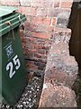
Ordnance Survey Cut Mark
This OS cut mark can be found on No25 Crowmere Road. It marks a point 63.239m above mean sea level.
Image: © Adrian Dust
Taken: 4 Jul 2023
0.06 miles
8
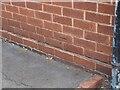
Ordnance Survey Cut Mark
This OS cut mark can be found on No79 Monkmoor Road. It marks a point 63.002m above mean sea level.
Image: © Adrian Dust
Taken: 4 Jul 2023
0.06 miles
10
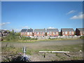
New House Alongside Railway at Shrewsbury
Image: © Roy Hughes
Taken: 15 Oct 2016
0.08 miles