1
War Memorial in Llanddewi-Brefi, Ceredigion
The cemetery in Llanddewi-Brefi also has this war memorial situated near the main gate. Everything is beautifully maintained.
Image]
Image]
Image: © Roger D Kidd
Taken: 19 Aug 2014
0.06 miles
2
War Memorial (detail) in Llanddewi-Brefi, Ceredigion
The cemetery in Llanddewi-Brefi also has this war memorial situated near the main gate. Everything is beautifully maintained.
Image]
Image]
Image: © Roger D Kidd
Taken: 19 Aug 2014
0.06 miles
3
War Memorial and Elenydd Hills, Llanddewi-Brefi, Ceredigion
This cemetery is beautifully maintained and is a credit to the village.
Image: © Roger Kidd
Taken: 26 Jul 2007
0.06 miles
4
Cemetery at Llanddewi-Brefi, Ceredigion
The cemetery in Llanddewi-Brefi also has a fine war memorial situated near the main gate. Everything is beautifully maintained. At the foot of the Elenydd moorland is the farm at Prysg.
Image]
Image: © Roger D Kidd
Taken: 19 Aug 2014
0.06 miles
5
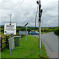
The B4343 at Llanddewi Brefi, Ceredigion
A clutter of street furniture here includes an old style road sign, an increasingly scarce sight.
Image: © Roger D Kidd
Taken: 18 Jul 2009
0.07 miles
6
Northern approach to Llandewi Brefi
The B4343 reaches the northern boundary of the village.
Image: © Nigel Brown
Taken: 17 Oct 2012
0.07 miles
7
Dim Ffordd Drwodd / No Through Road
Cerddwyr yn dilyn Heol Dim Ffordd Drwodd wrth adael pentref Llanddewi Brefi.
Walkers following a No Through Road while leaving Llanddewi Brefi (trans. St David's Church on the [river] Brefi).
Image: © Alan Richards
Taken: 17 Nov 2019
0.11 miles
8
Ordnance Survey Cut Mark
This OS cut mark can be found on the SW face of the school. It marks a point 173.530m above mean sea level.
Image: © Adrian Dust
Taken: 27 Aug 2017
0.12 miles
9
Ysgol Llanddewi Brefi in Ceredigion
The school is shown here in 2012. It has since been closed down (in 2018) and is to be sold for £165,000.
Children are now taught at the new Ysgol Henry Richard 3-1 in Tregaron.
Image: © Roger Kidd
Taken: 26 Jul 2012
0.12 miles
10
Beware of frogs on the road to Tregaron
or "BE NICE TO OUR FROGS"
Leaving Llanffroggi Brefi looking north on the B4343 near the junction with the road to Pont Llanio. ;-)
Image: © Roger Kidd
Taken: 28 Jul 2012
0.13 miles


