1
Guardians of the grid line
The three ponies stand on a raised embankment by the side of the trackbed of the erstwhile Aberystwyth-to-Carmarthen railway line. Further north, Sustrans route 82 http://www.geograph.org.uk/photo/5700042 follows the alignment but is diverted onto the B4343 south of the Cors Caron visitor centre. The loop path http://www.geograph.org.uk/photo/5699840 branches off on boardwalks into Cors Caron at this point.
Image: © Rudi Winter
Taken: 25 Feb 2018
0.04 miles
2
Access to the cycleway from the B4343
Not shown on the 1:25k OS map.
Image: © David Medcalf
Taken: 4 Aug 2022
0.05 miles
3
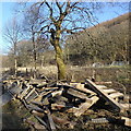
Removed boardwalk segments, Cors Caron
The loop path http://www.geograph.org.uk/photo/5699840 which provides easy pedestrian access into Cors Caron on flat and smooth boardwalk surfaces is currently (early 2018) being refurbished. A large amount of boardwalk segments which have recently been replaced are piled up by the side of the old railway alignment skirting the eastern boundary of the bog. There is a short section of old boardwalk which hasn't been replaced yet and is currently closed as it is a bit wobbly and has a few planks missing. Meanwhile, the bird hide http://www.geograph.org.uk/photo/2756511 remains accessible from the other end of the loop path, 200m north along the trackbed.
Image: © Rudi Winter
Taken: 25 Feb 2018
0.05 miles
4
The Edge of Cors Caron, Ceredigion
The course of the former Manchester and Milford Railway* on its way to Aberystwyth runs through the trees and across the bog further north. A red kite (I think) appeared while I was lining up the picture - not seen by me until later.
This railway went to neither Manchester nor Milford!! http://www.railbrit.co.uk/Manchester_and_Milford_Railway/frame.htm
Image: © Roger D Kidd
Taken: 20 Mar 2009
0.06 miles
5
Former railway trackbed
Former railway trackbed at Cors Caron. The railway was the line between Carmarthen and Aberystwyth. The line closed in 1964 when the line flooded and was financially not viable to repair.
Image: © Philip Halling
Taken: 15 Jul 2021
0.07 miles
6
Bike park and bog near Tregaron, Ceredigion
The Bog of Tregaron (Cors Caron) can be seen with some controlled woodland on the right.http://www.ccw.gov.uk/landscape--wildlife/protecting-our-landscape/special-landscapes--sites/protected-landscapes/national-nature-reserves/cors-caron.aspx?lang=en
Cycling is not permitted on the two mile circular board walk which goes into Cors Caron from here. These contemporary sculpturesque structures give riders something to which their machines can be locked. I walked mine around and no-one complained. Oh, if you want the other sort of bog it's about 800 metres along the dismantled railway track off to the right. :-)
Image: © Roger D Kidd
Taken: 14 Jul 2011
0.07 miles
7
Archway leading from Cors Caron, near Tregaron, Ceredigion
These attractive wooden arches have some intricate decorative carvings on them depicting local wildlife and plant life. They are placed at the entrance to the excellent board-walk onto and across the bog. Beyond is the course of the old railway.
http://www.geograph.org.uk/photo/1215236 http://www.geograph.org.uk/photo/1214391
Image: © Roger D Kidd
Taken: 20 Jul 2009
0.07 miles
8
Mynedfa i Gors Caron / Entrance to Cors Caron
Mynedfa o ochr Tregaron i Gors Caron.
The Tregaron end entrance to Cors Caron (trans. Caron's bog).
Image: © Alan Richards
Taken: 22 May 2019
0.07 miles
9
Carved woodwork (detail) by Cors Caron, Ceredigion
Some attractive wooden arches placed at the entrance to the excellent board-walk onto and across the bog have intricate decorative carvings on them depicting local wildlife and plant life. Beyond is the course of the old railway.
http://www.geograph.org.uk/photo/1215236 http://www.geograph.org.uk/photo/1214391 http://www.geograph.org.uk/photo/1420350
Image: © Roger D Kidd
Taken: 20 Jul 2009
0.07 miles
10
Former railway trackbed at Cors Caron
Former railway trackbed at Cors Caron. The railway was the line from Carmarthen and Aberystwyth. The line closed in 1964 when the line flooded and was not financially viable to repair.
Image: © Philip Halling
Taken: 15 Jul 2021
0.08 miles


