IMAGES TAKEN NEAR TO
TALYBONT, SY24 5HF
Introduction
This page details the photographs taken nearby to SY24 5HF by members of the Geograph project.
The Geograph project started in 2005 with the aim of publishing, organising and preserving representative images for every square kilometre of Great Britain, Ireland and the Isle of Man.

There are currently over 7.5m images from over14,400 individuals and you can help contribute to the project by visiting https://www.geograph.org.uk
Image Map
Images are licensed for reuse under creativecommons.org/licenses/by-sa/2.0
Notes
- Clicking on the map will re-center to the selected point.
- The higher the marker number, the further away the image location is from the centre of the postcode.
Image Listing (34 Images Found)
Images are licensed for reuse under creativecommons.org/licenses/by-sa/2.0
Image
Details
Distance
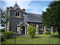
4
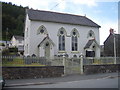
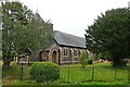
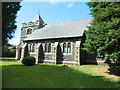
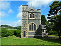
A487 Tal-y-bont passing road to St David's church
Image: © Roy Hughes
Taken: 26 Aug 2019
0.03 miles
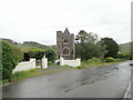
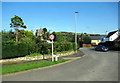
7
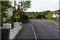
Election poster at the north end of Tal-y-bont
The poster signals the forthcoming election for the Welsh Assembly. Elin Jones was duly elected.
Image: © Bill Boaden
Taken: 1 May 2011
0.04 miles