IMAGES TAKEN NEAR TO
Llanafan, ABERYSTWYTH, SY23 4BQ
Introduction
This page details the photographs taken nearby to SY23 4BQ by members of the Geograph project.
The Geograph project started in 2005 with the aim of publishing, organising and preserving representative images for every square kilometre of Great Britain, Ireland and the Isle of Man.

There are currently over 7.5m images from over14,400 individuals and you can help contribute to the project by visiting https://www.geograph.org.uk
Image Map (Loading...)


Getting Data...Please wait
Leaflet Map data © OpenStreetMap
Images are licensed for reuse under creativecommons.org/licenses/by-sa/2.0
Notes
- Clicking on the map will re-center to the selected point.
- The higher the marker number, the further away the image location is from the centre of the postcode.
Image Listing (11 Images Found)
Images are licensed for reuse under creativecommons.org/licenses/by-sa/2.0
Image
Details
Distance
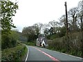
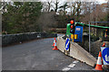
2
Empty campsite - Pont Llanafan
Currently closed due to the pandemic
Image: © John Lucas
Taken: 19 Apr 2021
0.01 miles
4
Afon Ystwyth
Upstream from Pont Llanafan by Pen-y-bont.
Image: © John Lucas
Taken: 19 Apr 2021
0.06 miles
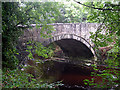
5
B4340 bridge over the Ystwyth
With the parapet undergoing yet another repair.
Image: © Nigel Brown
Taken: 30 Nov 2009
0.07 miles
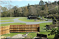
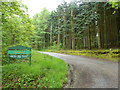
6
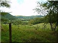
Coed Tynbedw
This is the super view from a bench in this forest area. There are many waymarked walks through the trees. A stream winds its way through the forest.
Image: © Angella Streluk
Taken: Unknown
0.08 miles
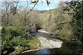
7
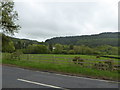
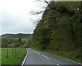
The wide valley of the Ystwyth near Llanafan
Image: © Eirian Evans
Taken: 22 May 2015
0.10 miles
8
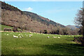
Pasture by Llwynprenteg
The Llwyn Gogau ridge stretches above.
Image: © John Lucas
Taken: 19 Apr 2021
0.15 miles
10
Coed Tynybedw
Forestry Commission woodland near Llanafan
Image: © Eirian Evans
Taken: 22 May 2015
0.18 miles