IMAGES TAKEN NEAR TO
Comins Coch, ABERYSTWYTH, SY23 3BE
Introduction
This page details the photographs taken nearby to SY23 3BE by members of the Geograph project.
The Geograph project started in 2005 with the aim of publishing, organising and preserving representative images for every square kilometre of Great Britain, Ireland and the Isle of Man.

There are currently over 7.5m images from over14,400 individuals and you can help contribute to the project by visiting https://www.geograph.org.uk
Image Map
Images are licensed for reuse under creativecommons.org/licenses/by-sa/2.0
Notes
- Clicking on the map will re-center to the selected point.
- The higher the marker number, the further away the image location is from the centre of the postcode.
Image Listing (20 Images Found)
Images are licensed for reuse under creativecommons.org/licenses/by-sa/2.0
Image
Details
Distance
2
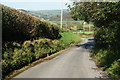
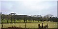
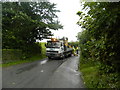
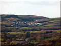
The Capel Dewi road
It has a steep descent which offers views across the valley between Afon Peithyll and Afon Rheidol.
Image: © Bill Boaden
Taken: 27 Sep 2011
0.06 miles
6
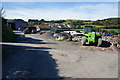
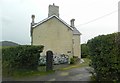
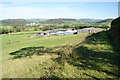
The approach to Troedrhiwgwinau Farm
Farms appear to attract debris.
Image: © Bill Boaden
Taken: 27 Sep 2011
0.14 miles
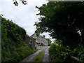
9
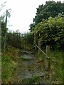
Troedrhiwgwinau
A farm near Comins Coch. The path through the farm is not well signed, but the basic rule is stick to the higher ground.
Image: © Bill Boaden
Taken: 27 Sep 2011
0.16 miles