IMAGES TAKEN NEAR TO
Upper Sarnau, LLANYMYNECH, SY22 6QP
Introduction
This page details the photographs taken nearby to SY22 6QP by members of the Geograph project.
The Geograph project started in 2005 with the aim of publishing, organising and preserving representative images for every square kilometre of Great Britain, Ireland and the Isle of Man.

There are currently over 7.5m images from over14,400 individuals and you can help contribute to the project by visiting https://www.geograph.org.uk
Image Map
Images are licensed for reuse under creativecommons.org/licenses/by-sa/2.0
Notes
- Clicking on the map will re-center to the selected point.
- The higher the marker number, the further away the image location is from the centre of the postcode.
Image Listing (3 Images Found)
Images are licensed for reuse under creativecommons.org/licenses/by-sa/2.0
Image
Details
Distance
1
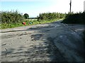
Large lane junction
Here five lanes meet and I must select my lane correctly.
Image: © Jeremy Bolwell
Taken: 29 Sep 2023
0.10 miles
2
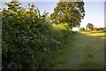
Hedgerow and field
Hedgerow and field near Little Rhos Farm
Image: © P Gaskell
Taken: Unknown
0.13 miles
3
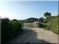
Looking over to Gaer-fawr Hill near Guilsfield
Ha! I am looking back on the woodland that I struggled through earlier this morning. And fields I traipsed through, before dodging cattle and detouring to these lanes. It looks peaceful and serene now.
Image: © Jeremy Bolwell
Taken: 29 Sep 2023
0.18 miles