IMAGES TAKEN NEAR TO
Pont Robert, MEIFOD, SY22 6HX
Introduction
This page details the photographs taken nearby to SY22 6HX by members of the Geograph project.
The Geograph project started in 2005 with the aim of publishing, organising and preserving representative images for every square kilometre of Great Britain, Ireland and the Isle of Man.

There are currently over 7.5m images from over14,400 individuals and you can help contribute to the project by visiting https://www.geograph.org.uk
Image Map
Images are licensed for reuse under creativecommons.org/licenses/by-sa/2.0
Notes
- Clicking on the map will re-center to the selected point.
- The higher the marker number, the further away the image location is from the centre of the postcode.
Image Listing (15 Images Found)
Images are licensed for reuse under creativecommons.org/licenses/by-sa/2.0
Image
Details
Distance
1
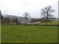
View to a farm from part of Glyndwr's Way
One of those spectacularly interesting farms that exhibits the farmers penchant for stock car racing / autograss, cannibalising parts form lorries and assorted vehicles, old vehicles and a cavalier attitude to laying them out.
Image: © Jeremy Bolwell
Taken: 23 Feb 2014
0.05 miles
2
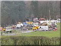
Farm laager
This farmer has quite a collection going on here. Great to see. Good work.
Image: © Jeremy Bolwell
Taken: 23 Feb 2014
0.05 miles
3
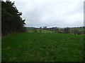
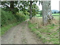
Part of Glyndwr's Way outside Pontrobert
Lovely rolling countryside with clear views in winter.
Image: © Jeremy Bolwell
Taken: 26 Dec 2011
0.12 miles
4
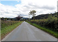
Straight road approaching Dolobran Hall turning
Image: © John Firth
Taken: 7 Aug 2012
0.19 miles
6
Not Required Today
Despite the appearance of good weather, it was only a temporary break in the rain. Consequently, irrigation equipment stands idle in a rain-soaked field.
Image: © Roger Gilbertson
Taken: 10 Jan 2007
0.22 miles
7
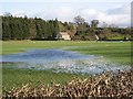
Watery Pasture
After persistent rain the land becomes waterlogged despite being bordered by the River Vyrnwy / Afon Efymwy.
Image: © Roger Gilbertson
Taken: 10 Jan 2007
0.22 miles
8
The Road To The A495
From Pontrobert.
Image: © Roger Gilbertson
Taken: 10 Jan 2007
0.22 miles
9
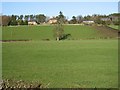
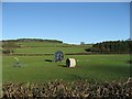
Towards Dolobran Hall
Farmland of the farm seen on the hill in the background.
Image: © Roger Gilbertson
Taken: 10 Jan 2007
0.22 miles
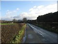
10
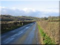
Along The Valley Bottom
The road to Pontrobert from the A495.
Image: © Roger Gilbertson
Taken: 10 Jan 2007
0.22 miles