IMAGES TAKEN NEAR TO
Hendre, WELSHPOOL, SY21 0QD
Introduction
This page details the photographs taken nearby to Hendre, SY21 0QD by members of the Geograph project.
The Geograph project started in 2005 with the aim of publishing, organising and preserving representative images for every square kilometre of Great Britain, Ireland and the Isle of Man.

There are currently over 7.5m images from over14,400 individuals and you can help contribute to the project by visiting https://www.geograph.org.uk
Image Map
Images are licensed for reuse under creativecommons.org/licenses/by-sa/2.0
Notes
- Clicking on the map will re-center to the selected point.
- The higher the marker number, the further away the image location is from the centre of the postcode.
Image Listing (12 Images Found)
Images are licensed for reuse under creativecommons.org/licenses/by-sa/2.0
Image
Details
Distance
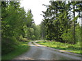
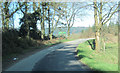
1
Road junction at Hendre
Looking north east from B4395
Image: © John Firth
Taken: 28 Mar 2012
0.01 miles
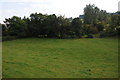
2
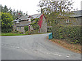
Hendre
A couple of cottages at the south-eastern corner of Dyfnant Forest
Image: © Oliver Dixon
Taken: 13 Sep 2007
0.02 miles
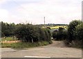
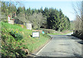
8
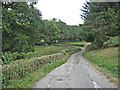
Road to Pentre-cyffin
Minor road off the B4395 crosses a minor tributary of the River Vyrnwy.
Image: © Oliver Dixon
Taken: 13 Sep 2007
0.23 miles
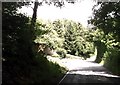
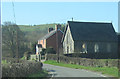
9
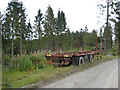
Forestry trailer, Dyfnant Forest
Apparently abandoned.
Image: © Oliver Dixon
Taken: 13 Sep 2007
0.23 miles