IMAGES TAKEN NEAR TO
Llangyniew, WELSHPOOL, SY21 0JX

Introduction

This page details the photographs taken nearby to SY21 0JX by members of the Geograph project.

The Geograph project started in 2005 with the aim of publishing, organising and preserving representative images for every square kilometre of Great Britain, Ireland and the Isle of Man.

There are currently over 7.5m images from over14,400 individuals and you can help contribute to the project by visiting https://www.geograph.org.uk

Image Map


Images are licensed for reuse under creativecommons.org/licenses/by-sa/2.0
Notes
  • Clicking on the map will re-center to the selected point.
  • The higher the marker number, the further away the image location is from the centre of the postcode.

Image Listing (7 Images Found)

Images are licensed for reuse under creativecommons.org/licenses/by-sa/2.0
Image
Details
Distance
1
The B4382
Between Glascoed and Dolanog.
Image: © Roger Gilbertson Taken: 10 Jan 2007
0.11 miles
2
"Sorry To Interrupt Your Meal"
Grazing sheep, beside the B4382, look up at the approach of a Geographer.
Image: © Roger Gilbertson Taken: 10 Jan 2007
0.11 miles
3
A View From The B4382
The clipped hedge in the foreground is as typical of the area as dry stone walls or drains in other parts of the country.
Image: © Roger Gilbertson Taken: 10 Jan 2007
0.11 miles
4
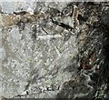
Ordnance Survey Cut Mark
This OS cut mark can be found on the SW face of Capel Peniel. It marks a point 123.150m above mean sea level.
Image: © Adrian Dust Taken: 25 Sep 2016
0.12 miles
5
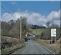
The B4382 where it crosses Yr Hafesb
Image: © Anthony Parkes Taken: 25 Mar 2016
0.18 miles
6
Junction of the B4382 and the A495
Image: © Steven Brown Taken: 18 Nov 2022
0.20 miles
7
Junction of A495 and B4382
Image: © John Firth Taken: 9 Nov 2009
0.21 miles