IMAGES TAKEN NEAR TO
Plas Talgarth, MACHYNLLETH, SY20 9LG
Introduction
This page details the photographs taken nearby to Plas Talgarth, SY20 9LG by members of the Geograph project.
The Geograph project started in 2005 with the aim of publishing, organising and preserving representative images for every square kilometre of Great Britain, Ireland and the Isle of Man.

There are currently over 7.5m images from over14,400 individuals and you can help contribute to the project by visiting https://www.geograph.org.uk
Image Map
Images are licensed for reuse under creativecommons.org/licenses/by-sa/2.0
Notes
- Clicking on the map will re-center to the selected point.
- The higher the marker number, the further away the image location is from the centre of the postcode.
Image Listing (6 Images Found)
Images are licensed for reuse under creativecommons.org/licenses/by-sa/2.0
Image
Details
Distance
2
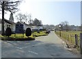
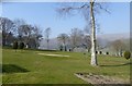
Plas Talgarth
Georgian Mansion set in an elevated position SW of Pennal village, overlooking the Dyffryn Dyfi. It now forms the centrepiece of a small residential timeshare and leisure/Country Club.
Image: © Eirian Evans
Taken: 18 Mar 2016
0.06 miles
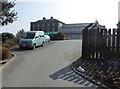
3
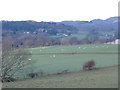
Plas Talgarth Hotel complex
Seen across the fields of the Dovey Valley
Image: © Tim Lloydlangston
Taken: 20 Mar 2007
0.10 miles
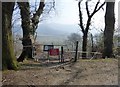
5
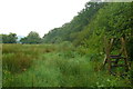
Camfa ar lwybr cyhoeddus / A stile on a public footpath
Llystyfiant mawr ar y morfa / Extensive vegetation growth on the marsh.
Image: © Ian Medcalf
Taken: 7 Jun 2014
0.22 miles