IMAGES TAKEN NEAR TO
Glan Y Nant, Manthrig Lane, CAERSWS, SY17 5EH

Introduction

This page details the photographs taken nearby to Glan Y Nant, Manthrig Lane, SY17 5EH by members of the Geograph project.

The Geograph project started in 2005 with the aim of publishing, organising and preserving representative images for every square kilometre of Great Britain, Ireland and the Isle of Man.

There are currently over 7.5m images from over14,400 individuals and you can help contribute to the project by visiting https://www.geograph.org.uk

Image Map


Images are licensed for reuse under creativecommons.org/licenses/by-sa/2.0
Notes
  • Clicking on the map will re-center to the selected point.
  • The higher the marker number, the further away the image location is from the centre of the postcode.

Image Listing (166 Images Found)

Images are licensed for reuse under creativecommons.org/licenses/by-sa/2.0
  • ...
Image
Details
Distance
1
Glan-y-nant Caersws
Cul-de-sac on the east side of Manthrig Lane.
Image: © Jaggery Taken: 4 Nov 2015
0.01 miles
2
Manthrig Lane houses, Caersws
Accessed by walkers via the wooden bridge over Manthrig Brook on the right.
Image: © Jaggery Taken: 4 Nov 2015
0.03 miles
3
Ivy-clad single-storey building, Manthrig Lane, Caersws
There is more ivy than building visible in early November 2015.
Image: © Jaggery Taken: 4 Nov 2015
0.03 miles
4
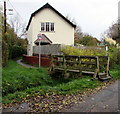
Wooden footbridge to a public footpath, Caersws
From Manthrig Lane across Manthrig Brook.
Image: © Jaggery Taken: 4 Nov 2015
0.04 miles
5
Main Street houses in Caersws
Row of houses viewed across the B4569 Main Street.
Image: © Jaggery Taken: 4 Nov 2015
0.04 miles
6
Warning sign- playground ahead, Caersws
The red-edged triangular sign showing Playground and its Welsh equivalent Maes chwarae is alongside SLOW/ARAF painted on Main Street, on the approach to this http://www.geograph.org.uk/photo/4728762 playground. Dominating the view is Caersws Presbyterian Church. http://www.geograph.org.uk/photo/4728753
Image: © Jaggery Taken: 4 Nov 2015
0.05 miles
7
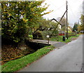
Small bridge over Manthrig Brook, Caersws
From Manthrig Lane to Brookside Cottage.
Image: © Jaggery Taken: 4 Nov 2015
0.05 miles
8
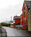
Main Street houses, Caersws
Viewed from the corner of Manthrig Lane looking towards Caersws Presbyterian Church. http://www.geograph.org.uk/photo/4728753
Image: © Jaggery Taken: 4 Nov 2015
0.05 miles
9
The Buck Hotel, Caersws
Extending for 35 metres along Main Street.
Image: © Jaggery Taken: 4 Nov 2015
0.05 miles
10
Chapel Street towards Main Street, Caersws
Caersws Baptist Church http://www.geograph.org.uk/photo/4728748 is on the right.
Image: © Jaggery Taken: 4 Nov 2015
0.05 miles
  • ...