IMAGES TAKEN NEAR TO
LLANDINAM, SY17 5DL
Introduction
This page details the photographs taken nearby to SY17 5DL by members of the Geograph project.
The Geograph project started in 2005 with the aim of publishing, organising and preserving representative images for every square kilometre of Great Britain, Ireland and the Isle of Man.

There are currently over 7.5m images from over14,400 individuals and you can help contribute to the project by visiting https://www.geograph.org.uk
Image Map
Images are licensed for reuse under creativecommons.org/licenses/by-sa/2.0
Notes
- Clicking on the map will re-center to the selected point.
- The higher the marker number, the further away the image location is from the centre of the postcode.
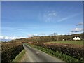
Image Listing (9 Images Found)
Images are licensed for reuse under creativecommons.org/licenses/by-sa/2.0
Image
Details
Distance
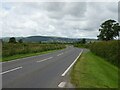
5
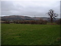
Farmland near Caersws
Looking towards Moel Iart.
Image: © David Medcalf
Taken: 15 Mar 2007
0.17 miles

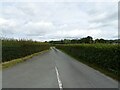
7
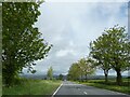
A flat landscape, A470 north of Llandinam
Image: © David Smith
Taken: 5 May 2023
0.23 miles
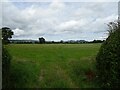
9
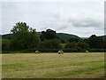
Cut silage field with bales near Llandinam Hall
Image: © JThomas
Taken: 2 Jul 2024
0.23 miles