IMAGES TAKEN NEAR TO
Beehive Lane, NEWTOWN, SY16 3NA
Introduction
This page details the photographs taken nearby to Beehive Lane, SY16 3NA by members of the Geograph project.
The Geograph project started in 2005 with the aim of publishing, organising and preserving representative images for every square kilometre of Great Britain, Ireland and the Isle of Man.

There are currently over 7.5m images from over14,400 individuals and you can help contribute to the project by visiting https://www.geograph.org.uk
Image Map
Images are licensed for reuse under creativecommons.org/licenses/by-sa/2.0
Notes
- Clicking on the map will re-center to the selected point.
- The higher the marker number, the further away the image location is from the centre of the postcode.
Image Listing (10 Images Found)
Images are licensed for reuse under creativecommons.org/licenses/by-sa/2.0
Image
Details
Distance
1
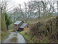
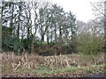
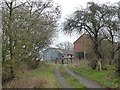
Beehive Lane
Approaching Neuadd Hendidley.
These are the outbuildings, the substantial house is around the corner on the left - pics (and sale details) are towards the bottom of this page https://www.zoopla.co.uk/property/neuadd-hendidley/beehive-lane/aberhafesp/newtown/sy16-3na/23542662
Image: © Penny Mayes
Taken: 25 Dec 2018
0.02 miles
2
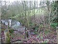
Pool by Neuadd Hendidley Farm, Beehive Lane
Fed from the pond above http://www.geograph.org.uk/photo/6014825 - you can just see the water trickling in, right of centre. The brook flows on down the hill and joins the River Severn about 600m below.
Image: © Penny Mayes
Taken: 25 Dec 2018
0.05 miles
3
Pool by Neuadd Hendidley Farm, Beehive Lane
Fed from the pond above http://www.geograph.org.uk/photo/6014825 - you can just see the water trickling in, right of centre. The brook flows on down the hill and joins the River Severn about 600m below.
Image: © Penny Mayes
Taken: 25 Dec 2018
0.05 miles
4
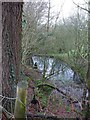
Pond by Neuadd Hendidley Farm, Beehive Lane
Looking at Google streetview images https://goo.gl/maps/S6hLqS6m1eG2 this doesn't look much like a pond even in summer, more of a reed-infested swamp. It is fed by a spring which rises not far away up the hill and drains under the road into a brook which joins the River Severn about 600m below.
Image: © Penny Mayes
Taken: 25 Dec 2018
0.06 miles
5
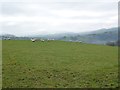
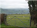
Pasture by Neuadd Hendidley Farm, Beehive Lane
The early fog had lifted but hung around in the hills.
Image: © Penny Mayes
Taken: 25 Dec 2018
0.08 miles
6
Pasture by Neuadd Hendidley Farm
The morning fog had lifted a bit by midday.
Image: © Penny Mayes
Taken: 25 Dec 2018
0.09 miles
7
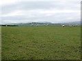
Pasture by Neuadd Hendidley Farm, Beehive Lane
The early fog had lifted but hung around in the hills.
Image: © Penny Mayes
Taken: 25 Dec 2018
0.09 miles
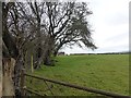
8
Neuadd Hendidley Farm, Beehive Lane
The pond http://www.geograph.org.uk/photo/6014825 is out of shot on the left.
Image: © Penny Mayes
Taken: 25 Dec 2018
0.09 miles
9
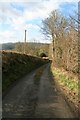
Beehive Lane
Winter sun lights the bare trees and hedges of Beehive Lane, which runs down to the B4568 a few kilometres west of Newtown / Y Drenewydd.
Image: © John Gibson
Taken: 21 Mar 2008
0.13 miles