IMAGES TAKEN NEAR TO
Llanfair Road, NEWTOWN, SY16 3JZ
Introduction
This page details the photographs taken nearby to Llanfair Road, SY16 3JZ by members of the Geograph project.
The Geograph project started in 2005 with the aim of publishing, organising and preserving representative images for every square kilometre of Great Britain, Ireland and the Isle of Man.

There are currently over 7.5m images from over14,400 individuals and you can help contribute to the project by visiting https://www.geograph.org.uk
Image Map
Images are licensed for reuse under creativecommons.org/licenses/by-sa/2.0
Notes
- Clicking on the map will re-center to the selected point.
- The higher the marker number, the further away the image location is from the centre of the postcode.
Image Listing (6 Images Found)
Images are licensed for reuse under creativecommons.org/licenses/by-sa/2.0
Image
Details
Distance
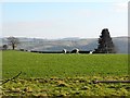
1
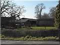
Barns at Tynyreithin Hall Farm
Situated on a double bend of the Llanfair Road just north of Newtown.
Image: © Penny Mayes
Taken: 6 Mar 2011
0.02 miles
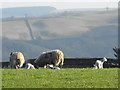
2
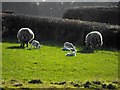
Ewes and lambs near Tynyreithin Hall Farm
In a field by a double bend of the Llanfair Road just north of Newtown.
Image: © Penny Mayes
Taken: 6 Mar 2011
0.06 miles
3
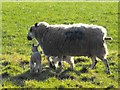
Ewe and lambs near Tynyreithin Hall Farm
In a field by a double bend of the Llanfair Road just north of Newtown.
Image: © Penny Mayes
Taken: 6 Mar 2011
0.09 miles
4
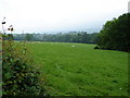
Grazing Near Gwestydd
Sheep grazing happily in the lush, wet grass.
Image: © Ian Paterson
Taken: 27 May 2008
0.11 miles
5
Ewes and lambs near Tynyreithin Hall Farm
In a field by a double bend of the Llanfair Road just north of Newtown.
Image: © Penny Mayes
Taken: 6 Mar 2011
0.13 miles
6
Ewes and lambs near Tynyreithin Hall Farm
In a field by a double bend of the Llanfair Road just north of Newtown.
Image: © Penny Mayes
Taken: 6 Mar 2011
0.13 miles