IMAGES TAKEN NEAR TO
Adfa, NEWTOWN, SY16 3DE
Introduction
This page details the photographs taken nearby to SY16 3DE by members of the Geograph project.
The Geograph project started in 2005 with the aim of publishing, organising and preserving representative images for every square kilometre of Great Britain, Ireland and the Isle of Man.

There are currently over 7.5m images from over14,400 individuals and you can help contribute to the project by visiting https://www.geograph.org.uk
Image Map
Images are licensed for reuse under creativecommons.org/licenses/by-sa/2.0
Notes
- Clicking on the map will re-center to the selected point.
- The higher the marker number, the further away the image location is from the centre of the postcode.
Image Listing (9 Images Found)
Images are licensed for reuse under creativecommons.org/licenses/by-sa/2.0
Image
Details
Distance
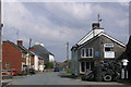
1
Field headland track
Field headland track in Rhiw valley near Llanllugan.
Image: © Philip Halling
Taken: 3 Jun 2018
0.04 miles
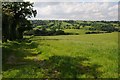
2
Rhiw valley
The Rhiw valley near Llanllugan.
Image: © Philip Halling
Taken: 3 Jun 2018
0.06 miles
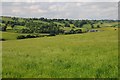
3
Meadow, north of Adfa
On the west side of the road to Llanllugan. About 250 metres above sea level.
Image: © Christine Johnstone
Taken: 18 Jun 2016
0.10 miles
4
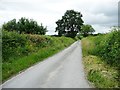
The road from Llanllugan to Adfa
Heading south.
Image: © Christine Johnstone
Taken: 18 Jun 2016
0.12 miles
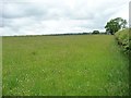
5
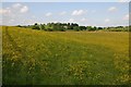
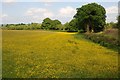
Field of buttercups
Field of buttercups near Adfa in the Rhiw valley.
Image: © Philip Halling
Taken: 3 Jun 2018
0.13 miles
6
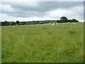
Grazing sheep, north of Adfa
On the west side of the road to Llanllugan.
Image: © Christine Johnstone
Taken: 18 Jun 2016
0.14 miles
7
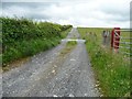
259 metre spot height on a farm track north of Adfa
The track heads west from the Adfa - Llanllugan road. It is not a public footpath.
Image: © Christine Johnstone
Taken: 18 Jun 2016
0.16 miles
8
A field of buttercups
A field of buttercups near Adfa in the Rhiw valley.
Image: © Philip Halling
Taken: 3 Jun 2018
0.18 miles