IMAGES TAKEN NEAR TO
Violet Close, NEWTOWN, SY16 1HN

Introduction

This page details the photographs taken nearby to Violet Close, SY16 1HN by members of the Geograph project.

The Geograph project started in 2005 with the aim of publishing, organising and preserving representative images for every square kilometre of Great Britain, Ireland and the Isle of Man.

There are currently over 7.5m images from over14,400 individuals and you can help contribute to the project by visiting https://www.geograph.org.uk

Image Map


Images are licensed for reuse under creativecommons.org/licenses/by-sa/2.0
Notes
  • Clicking on the map will re-center to the selected point.
  • The higher the marker number, the further away the image location is from the centre of the postcode.

Image Listing (57 Images Found)

Images are licensed for reuse under creativecommons.org/licenses/by-sa/2.0
  • ...
Image
Details
Distance
1
Footpath beneath the railway line
Image: © Row17 Taken: 27 Aug 2008
0.01 miles
2
The underpass from Nantoer, Llanidloes Road to Maesyrhandir Estate
A view from the Maesyrhandir estate of the railway underpass, Newtown, Powys
Image: © Henry Spooner Taken: 26 May 2009
0.02 miles
3
Corrugated iron hut
Image: © N Chadwick Taken: 18 Feb 2015
0.05 miles
4
Row of six houses in the west of Newtown
Set back from the south side of the A489 Llanidloes Road.
Image: © Jaggery Taken: 1 Feb 2017
0.05 miles
5
Footpath to a low railway bridge, Newtown
From the south side of Llanidloes Road towards a bridge carrying the Cambrian Line railway, located 1.5km west of Newtown railway station.
Image: © Jaggery Taken: 1 Feb 2017
0.06 miles
6
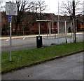
Damaged bus shelter, Llanidloes Road, Newtown
Viewed on February 1st 2017. The bilingual (Welsh/English) Powys County Council notice states that the leaving of vehicles for sale on the highway is prohibited under the terms of the Highways Act 1980. Offenders will be prosecuted. Maximum fine £1,000. The small blue sign indicates National Cycle Network Route 81.
Image: © Jaggery Taken: 1 Feb 2017
0.07 miles
7
Llanidloes Road pelican crossing, Newtown
Across the A489 Llanidloes Road in the west of Newtown. Chambers Dictionary states that pelican in this context is adapted from "pedestrian light controlled crossing".
Image: © Jaggery Taken: 1 Feb 2017
0.07 miles
8
Orchard walk
Image: © N Chadwick Taken: 19 Feb 2015
0.08 miles
9
Green Acres, Newtown
Cul-de-sac on the south side of the A489 Llanidloes Road and the north side of the Cambrian Line railway.
Image: © Jaggery Taken: 1 Feb 2017
0.08 miles
10
BT phonebox on a Newtown corner
On the corner of Llanidloes Road and Oakfield Terrace.
Image: © Jaggery Taken: 1 Feb 2017
0.08 miles
  • ...