1
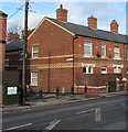
Terrace of three homes on New Road
Use of coloured brick decoration is typical of Victorian buildings in Newtown and the surrounding area. There are several examples on New Road, some more elaborate than others.
The bollards on the left mark the eastern end of Frolic Street - note the yellow stripes on the gable of the next terrace.
Image: © Penny Mayes
Taken: 18 Nov 2018
0.01 miles
2
Queen Elizabeth II postbox in a brick pillar, New Road, Newtown
Alongside a hedge between Frolic Street and New Church Street.
Image: © Jaggery
Taken: 1 Feb 2017
0.01 miles
3
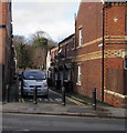
Metal posts across the SE end of Frolic Street, Newtown
Viewed across New Road. For walkers and cyclists, Frolic Street leads to Park Street.
According to one reference, Frolic Street is the only one so named in the UK.
Nor are there any other Frolics in the UK (ie no Frolic Road nor Frolic Avenue etc).
Image: © Jaggery
Taken: 1 Feb 2017
0.01 miles
4
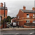
Two telecoms cabinets, New Road, Newtown
A dark green cabinet is on each side of Frolic Street.
Image: © Jaggery
Taken: 1 Feb 2017
0.01 miles
5
Row of houses, New Road, Newtown
Viewed from the corner of Ffordd Croesawdy. Lighter coloured bricks form a cross pattern on the chimneys.
Image: © Jaggery
Taken: 1 Feb 2017
0.02 miles
6
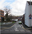
SE end of Frolic Street, Newtown
Frolic Street heads away from New Road towards Park Street.
Image: © Jaggery
Taken: 4 Aug 2013
0.02 miles
7
Frolic Street, Newtown
Extending for 110 metres from Park Street to the A483 New Road. This is not a through route
for motor vehicles because there are metal posts http://www.geograph.org.uk/photo/5278818 across the New Road end of the street.
According to one reference source, this is the only Frolic (Street or Road or Avenue etc) in the UK.
Image: © Jaggery
Taken: 1 Feb 2017
0.02 miles
8
Directions sign facing the A483 New Road, Newtown
On the approach to the town centre.
Image: © Jaggery
Taken: 1 Feb 2017
0.02 miles
9
Croesawdy, Drenewydd
A large house on the corner of Croesawdy Road and Llanidloes Road in Newtown. The name means Welcoming House. It was at one time a pub, but was also a Vicarage, which was when the name was changed.
Image: © Eirian Evans
Taken: 23 Sep 2007
0.02 miles
10
Travis Perkins, Newtown
The Travis Perkins timber and building supplies yard is on the SE side of New Road.
Image: © Jaggery
Taken: 4 Aug 2013
0.03 miles


