1
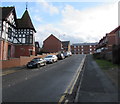
Up Ffordd Croesawdy, Newtown
Ffordd Croesawdy ascends from New Road. Walkers can turn left
at the top of the ascent for a route to Newtown railway station.
Image: © Jaggery
Taken: 1 Feb 2017
0.02 miles
2
Station Cottages, Ffordd Croesawdy, Newtown
Bungalows on the western approach to Newtown railway station.
Image: © Jaggery
Taken: 1 Feb 2017
0.02 miles
3
Flats, Llys Croesawdy
Image: © JThomas
Taken: 2 Jul 2024
0.02 miles
4
Croesawdy, Newtown
Detached house on the corner of New Road and Ffordd Croesawdy.
The former St David's church http://www.geograph.org.uk/photo/3584592 is in the background.
Image: © Jaggery
Taken: 4 Aug 2013
0.02 miles
5
West side of Ffordd Croesawdy, Newtown
The houses are alongside the descent towards New Road.
Image: © Jaggery
Taken: 1 Feb 2017
0.03 miles
6
Three tracks SW of Newtown railway station
Viewed from Newtown railway station platform 1. Newtown is on the Cambrian Line, which is mostly single track. The double tracks through and near the station enable trains to pass each other. The short section of track ending in buffers on the left is available for the stabling of wagons etc. The next station ahead is Caersws on the route to Aberystwyth.
Image: © Jaggery
Taken: 23 Jun 2013
0.04 miles
7
Travis Perkins, Newtown
The Travis Perkins timber and building supplies yard is on the SE side of New Road.
Image: © Jaggery
Taken: 4 Aug 2013
0.05 miles
8
Frolic Street, Newtown
Extending for 110 metres from Park Street to the A483 New Road. This is not a through route
for motor vehicles because there are metal posts http://www.geograph.org.uk/photo/5278818 across the New Road end of the street.
According to one reference source, this is the only Frolic (Street or Road or Avenue etc) in the UK.
Image: © Jaggery
Taken: 1 Feb 2017
0.05 miles
9
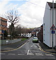
Ffordd Croesawdy descends towards New Road, Newtown
This part of Ffordd Croesawdy is at right angles to the main course of the road.
Image: © Jaggery
Taken: 1 Feb 2017
0.05 miles
10
Park Villas, New Road, Newtown
The inscription on the semi-detached houses is PARK VILLAS 1875.
Image: © Jaggery
Taken: 4 Aug 2013
0.06 miles


