IMAGES TAKEN NEAR TO
Garthmyl, MONTGOMERY, SY15 6SD
Introduction
This page details the photographs taken nearby to SY15 6SD by members of the Geograph project.
The Geograph project started in 2005 with the aim of publishing, organising and preserving representative images for every square kilometre of Great Britain, Ireland and the Isle of Man.

There are currently over 7.5m images from over14,400 individuals and you can help contribute to the project by visiting https://www.geograph.org.uk
Image Map
Images are licensed for reuse under creativecommons.org/licenses/by-sa/2.0
Notes
- Clicking on the map will re-center to the selected point.
- The higher the marker number, the further away the image location is from the centre of the postcode.
Image Listing (6 Images Found)
Images are licensed for reuse under creativecommons.org/licenses/by-sa/2.0
Image
Details
Distance
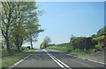
3
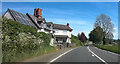
Kingsdown Cottage off A483 north of Fron
Image: © John Firth
Taken: 11 May 2024
0.14 miles
5
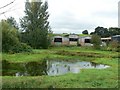
Duck pond
With agricultural storage buildings in the background.
Image: © James Allan
Taken: 2 Sep 2007
0.18 miles