IMAGES TAKEN NEAR TO
Churchstoke, MONTGOMERY, SY15 6HU
Introduction
This page details the photographs taken nearby to SY15 6HU by members of the Geograph project.
The Geograph project started in 2005 with the aim of publishing, organising and preserving representative images for every square kilometre of Great Britain, Ireland and the Isle of Man.

There are currently over 7.5m images from over14,400 individuals and you can help contribute to the project by visiting https://www.geograph.org.uk
Image Map (Loading...)


Getting Data...Please wait
Leaflet Map data © OpenStreetMap
Images are licensed for reuse under creativecommons.org/licenses/by-sa/2.0
Notes
- Clicking on the map will re-center to the selected point.
- The higher the marker number, the further away the image location is from the centre of the postcode.
Image Listing (10 Images Found)
Images are licensed for reuse under creativecommons.org/licenses/by-sa/2.0
Image
Details
Distance
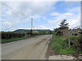
2
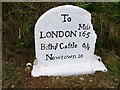
Old Milestone by the A489, Pentreheyling, Chirbury with Brompton parish
Carved stone post by the A489, in parish of Chirbury with Brompton (South Shropshire District), Pentreheyling; East of the Coach House, by the road, on North side of the road. Bishop's Castle arched stone, erected by the Bishop's Castle turnpike trust in the 18th century. Re-located from narrow verge on South side of road to wide grassy area on North side.
Inscription reads:-
To
.......Mile
LONDON 165
Biſhps Caſtle 6½
Newtown 10
Grade II listed.
List Entry Number: 1367271 https://historicengland.org.uk/listing/the-list/list-entry/1367271
Milestone Society National ID: SA_BCNT06
Image: © A Reade/J Higgins
Taken: 1 Mar 2006
0.09 miles
3
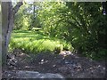
Over The Caebitra
Stone bridge over the Caebitre at Bacheldre.
Image: © Paul Beaman
Taken: 13 Feb 2008
0.11 miles
5
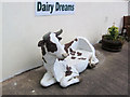
Bovine seat at Dairy Dreams ice cream parlour
Image: © John Firth
Taken: 13 Jul 2009
0.15 miles
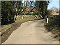
6
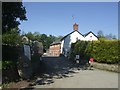
Bacheldre Mill
Former water mill beside the River Caebrita.The business produces a range of stoneground organic flours but no longer using water power. A mill is recorded on this site from the 16th Century.
Image: © John M
Taken: 24 May 2009
0.16 miles
7
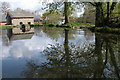
Mill Pond, Bacheldre Mill
The mill offers self-catering accommodation and a camping and caravan site.
Image: © Philip Halling
Taken: 1 May 2006
0.17 miles
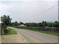
10
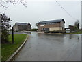
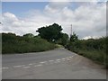
Kerry Vale Vineyard
Office building beside the road.
Image: © Jeremy Bolwell
Taken: 3 Mar 2019
0.24 miles