IMAGES TAKEN NEAR TO
Meadow Farm Drive, SHREWSBURY, SY1 4JX
Introduction
This page details the photographs taken nearby to Meadow Farm Drive, SY1 4JX by members of the Geograph project.
The Geograph project started in 2005 with the aim of publishing, organising and preserving representative images for every square kilometre of Great Britain, Ireland and the Isle of Man.

There are currently over 7.5m images from over14,400 individuals and you can help contribute to the project by visiting https://www.geograph.org.uk
Image Map
Images are licensed for reuse under creativecommons.org/licenses/by-sa/2.0
Notes
- Clicking on the map will re-center to the selected point.
- The higher the marker number, the further away the image location is from the centre of the postcode.
Image Listing (29 Images Found)
Images are licensed for reuse under creativecommons.org/licenses/by-sa/2.0
Image
Details
Distance
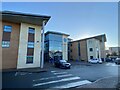
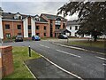
1
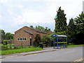
Bus Stop outside Our Lady of Pity Church
Bus stop outside Our Lady of Pity Church, on Meadow Farm Drive.
Image: © David Dixon
Taken: 2 Jun 2019
0.04 miles
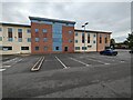
2
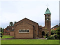
Our Lady of Pity Church, Shrewsbury
Our Lady of Pity Church on Meadow Farm Drive.
Image: © David Dixon
Taken: 2 Jun 2019
0.04 miles
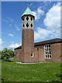
4
Our Lady of Pity Catholic church, Harlescott
Image: © Richard Law
Taken: 17 May 2010
0.05 miles
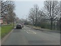
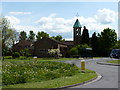
8
Bus stops and roundabout at the southern end of Meadow Farm Drive
Image: © Richard Law
Taken: 17 May 2010
0.08 miles
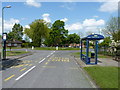
10
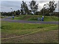
Cycle track at Shrewsbury Sports Village
Image: © TCExplorer
Taken: 14 Sep 2023
0.11 miles