IMAGES TAKEN NEAR TO
Whitchurch Road, SHREWSBURY, SY1 4EJ
Introduction
This page details the photographs taken nearby to Whitchurch Road, SY1 4EJ by members of the Geograph project.
The Geograph project started in 2005 with the aim of publishing, organising and preserving representative images for every square kilometre of Great Britain, Ireland and the Isle of Man.

There are currently over 7.5m images from over14,400 individuals and you can help contribute to the project by visiting https://www.geograph.org.uk
Image Map
Images are licensed for reuse under creativecommons.org/licenses/by-sa/2.0
Notes
- Clicking on the map will re-center to the selected point.
- The higher the marker number, the further away the image location is from the centre of the postcode.
Image Listing (23 Images Found)
Images are licensed for reuse under creativecommons.org/licenses/by-sa/2.0
Image
Details
Distance

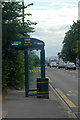
2
Dual use path beside Whitchurch Road (A5112)
Image: © JThomas
Taken: 3 Jul 2024
0.04 miles
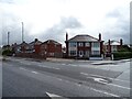
7
Harlescott social club from entrance on Roseway
Image: © John Firth
Taken: 28 Nov 2009
0.06 miles