IMAGES TAKEN NEAR TO
Wingfield Close, SHREWSBURY, SY1 4BH
Introduction
This page details the photographs taken nearby to Wingfield Close, SY1 4BH by members of the Geograph project.
The Geograph project started in 2005 with the aim of publishing, organising and preserving representative images for every square kilometre of Great Britain, Ireland and the Isle of Man.

There are currently over 7.5m images from over14,400 individuals and you can help contribute to the project by visiting https://www.geograph.org.uk
Image Map
Images are licensed for reuse under creativecommons.org/licenses/by-sa/2.0
Notes
- Clicking on the map will re-center to the selected point.
- The higher the marker number, the further away the image location is from the centre of the postcode.
Image Listing (88 Images Found)
Images are licensed for reuse under creativecommons.org/licenses/by-sa/2.0
Image
Details
Distance
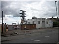
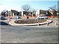
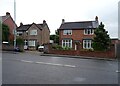
4
Roundabout on Ditherington Road
The housing estate beyond, known as Yew Tree Close, appears to be on the site of a former electricity transformer station Image
Image: © Stephen Craven
Taken: 16 Oct 2022
0.06 miles
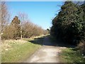
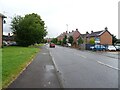
5
Shrewsbury Canal
The line of the canal crosses Spring Gardens.
Image: © John M
Taken: 24 Apr 2010
0.07 miles
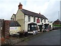
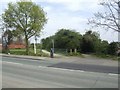
7
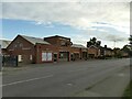
Frank Painter & Sons, Ditherington Road
Funeral directors.
Image: © Stephen Craven
Taken: 16 Oct 2022
0.09 miles