1
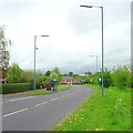
Cyle path off Ellesmere Road
Part of a network of suburban cycle paths funded by Sustrans' 'Connect2' scheme and constructed between 2008 and 2013.
Image: © Stephen Craven
Taken: 16 Oct 2022
0.06 miles
2
The Moveage, Ellesmere Road
Old maps do show a large of that name on a nearby site. Grace's Guide online shows it was occupied in 1917 by G. Woodvine, Engineer. But it's not the present structure. The grounds have been used to develop social housing.
Image: © Stephen Craven
Taken: 16 Oct 2022
0.07 miles
3
Ellesmere Road (A528), Shrewsbury
Looking north.
Image: © JThomas
Taken: 14 Mar 2019
0.07 miles
4
House on Ellesmere Road, Shrewsbury
Image: © JThomas
Taken: 14 Mar 2019
0.07 miles
5
Old Milestone by the A528, Ellesmere Road, north of Shrewsbury
Stone post (plate lost) by the A528, in parish of SHREWSBURY (SHREWSBURY AND ATCHAM District), opposite Normanton Retirement Home, Ellesmere Road, by the road. Erected by the Ellesmere District of Shrewsbury & Wrexham, & Harmer Hill Branch turnpike trust in the 19th century.
Inscription once read:-
(Shrewsbury 1)
Listed Shropshire HER: 21079 https://www.heritagegateway.org.uk/Gateway/Results_Single.aspx?uid=MSA23648&resourceID=1015
Milestone Society National ID: SA_WMSB09.
Image: © A Reade
Taken: 19 Aug 2008
0.09 miles
6
Bus stops at Mount Pleasant
Image: © Row17
Taken: 7 Nov 2008
0.12 miles
7
Entering Mount Pleasant on Ellesmere Road
Image: © John Firth
Taken: 13 Apr 2014
0.12 miles
8
Modern houses off Hubert Way, Shrewsbury
The houses are in Broadhaven Close. Hubert Way serves as the boundary road for the whole housing estate
Image: © David Smith
Taken: 23 Apr 2015
0.12 miles
9
Hubert Way
Hubert Way, looking towards its junction with Ellesmere Road (A528)
The junction on the left is Butterwick Drive.
This area is also known as Herongate.
Image: © Andrew Bennett
Taken: 24 Apr 2007
0.14 miles
10
Ellesmere Road junction with Hubert Way, Shrewsbury
Ellesmere Road is a boundary between farmland on the left and housing estates on the right. Hubert Way is also a boundary, between the estate and land liable to flooding, the old river bed of the Severn
Image
Image: © David Smith
Taken: 28 Nov 2014
0.15 miles


