IMAGES TAKEN NEAR TO
Maple Drive, SHREWSBURY, SY1 3SE
Introduction
This page details the photographs taken nearby to Maple Drive, SY1 3SE by members of the Geograph project.
The Geograph project started in 2005 with the aim of publishing, organising and preserving representative images for every square kilometre of Great Britain, Ireland and the Isle of Man.

There are currently over 7.5m images from over14,400 individuals and you can help contribute to the project by visiting https://www.geograph.org.uk
Image Map
Images are licensed for reuse under creativecommons.org/licenses/by-sa/2.0
Notes
- Clicking on the map will re-center to the selected point.
- The higher the marker number, the further away the image location is from the centre of the postcode.
Image Listing (29 Images Found)
Images are licensed for reuse under creativecommons.org/licenses/by-sa/2.0
Image
Details
Distance
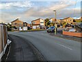
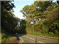
1
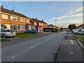
Looking south along Boscobel Drive, Shrewsbury
Image: © TCExplorer
Taken: 5 Oct 2023
0.07 miles
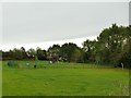
3
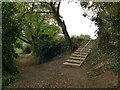
Steps to the playground
At the top of the steps is a playground Image; at the bottom, a woodland path.
Image: © Stephen Craven
Taken: 16 Oct 2022
0.10 miles
4
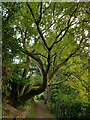
Path with twisted tree
A path through woodland at the top of the northern edge of the Old River Bed SSSI Image
Image: © Stephen Craven
Taken: 16 Oct 2022
0.10 miles
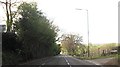
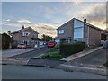
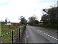
6
Ellesmere Road approaching Crosshill junction
Image: © John Firth
Taken: 13 Apr 2014
0.11 miles
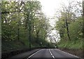
10
A528 towards Ellesmere
Looking north east.
Image: © JThomas
Taken: 14 Mar 2019
0.13 miles