1
The Church of Jesus Christ of Latter-day Saints, Shrewsbury
The Church of Jesus Christ of Latter-day Saints on Mount Pleasant Road at Harlescott Grange, Shrewsbury.
Image: © David Dixon
Taken: 1 Jun 2019
0.04 miles
2
The Church of Jesus Christ & Latter Day Saints in Mount Pleasant, Shrewsbury
Also known as Mormons. Their beliefs could safely be described as not mainstream I believe.
Image: © Jeremy Bolwell
Taken: 14 Sep 2020
0.05 miles
3
Church of Jesus Christ of latter-day saints
Church of Jesus Christ of latter-day Saints, Mount Pleasant Road, Shrewsbury
Image: © Andrew Bennett
Taken: 24 Apr 2007
0.05 miles
4
Mount Pleasant Junction
Entrance to Mount Pleasant Road, from A528 Ellesmere Road.
Image: © Andrew Bennett
Taken: 24 Apr 2007
0.06 miles
5
Bus stop on Ellesmere Road, Shrewsbury
On the northern edge of Shrewsbury, this stop serves the housing estates behind the hedge on the left. There is pedestrian access through the hedge by the small barrier opposite the leading car
Image: © David Smith
Taken: 23 Apr 2015
0.07 miles
6
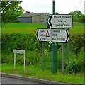
Signs at Mount Pleasant
Roadsigns on A528 Ellesmere Road, at Mount Pleasant junction.
Ellesmere Road defines one of the edges of the Northern part of Shrewsbury, to the East of the road is urban. To the West of Ellesmere Road is rural
Image: © Andrew Bennett
Taken: 24 Apr 2007
0.08 miles
7
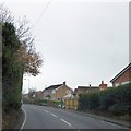
Ellesmere Road, passing houses in Harlescott
Ellesmere Road (A528) is a boundary between farmland and housing on the north of Shrewsbury. To the right are several estates, to the left, farms.
Image: © David Smith
Taken: 28 Nov 2014
0.08 miles
8
Housing on Mount Pleasant Road
Image: © Richard Law
Taken: 17 Jun 2014
0.08 miles
9
1950s semis on Little Harlescott Lane
Image: © Richard Law
Taken: 17 Jun 2014
0.13 miles
10
The Emmanuel Church
On Mount Pleasant Road, this is the local United Anglican Methodist Church.
Image: © Richard Law
Taken: 17 Jun 2014
0.14 miles


