IMAGES TAKEN NEAR TO
Ellesmere Road, WHITCHURCH, SY13 3HY
Introduction
This page details the photographs taken nearby to Ellesmere Road, SY13 3HY by members of the Geograph project.
The Geograph project started in 2005 with the aim of publishing, organising and preserving representative images for every square kilometre of Great Britain, Ireland and the Isle of Man.

There are currently over 7.5m images from over14,400 individuals and you can help contribute to the project by visiting https://www.geograph.org.uk
Image Map
Images are licensed for reuse under creativecommons.org/licenses/by-sa/2.0
Notes
- Clicking on the map will re-center to the selected point.
- The higher the marker number, the further away the image location is from the centre of the postcode.
Image Listing (5 Images Found)
Images are licensed for reuse under creativecommons.org/licenses/by-sa/2.0
Image
Details
Distance
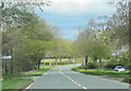
3
A495 Ellesmere Road towards Bronington
Image: © Steven Brown
Taken: 30 Oct 2022
0.12 miles
4
Holebrook farm entrance from Moss lane junction
A495 eastbound
Image: © John Firth
Taken: 14 Apr 2012
0.14 miles
5
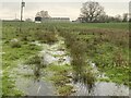
Flooded farmland
South of Mossfields Farm.
Image: © John H Darch
Taken: 7 Dec 2020
0.25 miles