IMAGES TAKEN NEAR TO
Redbrook Maelor, WHITCHURCH, SY13 3AQ
Introduction
This page details the photographs taken nearby to SY13 3AQ by members of the Geograph project.
The Geograph project started in 2005 with the aim of publishing, organising and preserving representative images for every square kilometre of Great Britain, Ireland and the Isle of Man.

There are currently over 7.5m images from over14,400 individuals and you can help contribute to the project by visiting https://www.geograph.org.uk
Image Map
Images are licensed for reuse under creativecommons.org/licenses/by-sa/2.0
Notes
- Clicking on the map will re-center to the selected point.
- The higher the marker number, the further away the image location is from the centre of the postcode.
Image Listing (10 Images Found)
Images are licensed for reuse under creativecommons.org/licenses/by-sa/2.0
Image
Details
Distance
1
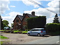
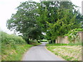
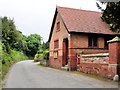
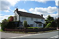
Whitewell - Broad Oak Farm
Bronington (Whitewell) - Broad Oak Farm and (?) local resident observing the photographer.
Image: © Mike Harris
Taken: 1 Jun 2008
0.03 miles
4
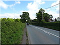
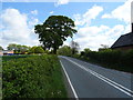
The road to Whitewell
Looking back towards the A525 on the road to Whitewell, with the walls of Broad Oak Farm on the right.
Image: © Eirian Evans
Taken: 19 Jun 2006
0.11 miles
6
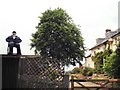
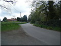
Chapel on Whitewell Road
Bronington (Whitewell) - chapel on Whitewell Road.
Image: © Mike Harris
Taken: 1 Jun 2008
0.12 miles
8
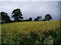
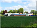
Farmland near Painter's Green
A field of wheat.
Image: © Eirian Evans
Taken: 19 Jun 2006
0.15 miles