IMAGES TAKEN NEAR TO
Whixall, WHITCHURCH, SY13 2QA
Introduction
This page details the photographs taken nearby to SY13 2QA by members of the Geograph project.
The Geograph project started in 2005 with the aim of publishing, organising and preserving representative images for every square kilometre of Great Britain, Ireland and the Isle of Man.

There are currently over 7.5m images from over14,400 individuals and you can help contribute to the project by visiting https://www.geograph.org.uk
Image Map
Images are licensed for reuse under creativecommons.org/licenses/by-sa/2.0
Notes
- Clicking on the map will re-center to the selected point.
- The higher the marker number, the further away the image location is from the centre of the postcode.
Image Listing (7 Images Found)
Images are licensed for reuse under creativecommons.org/licenses/by-sa/2.0
Image
Details
Distance
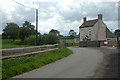
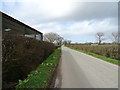
4
Lane at Poolbank, west of Waterloo Bridge
Image: © Colin Pyle
Taken: 29 Nov 2014
0.13 miles
6
Cycle Route 455 near Rose Farm
Looking north west.
Image: © JThomas
Taken: 14 Mar 2019
0.17 miles
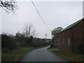
7
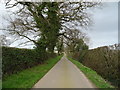
Lane towards Poolbank
Looking north west near Beech Bank Farm.
Image: © JThomas
Taken: 14 Mar 2019
0.23 miles