1
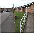
NCR 45 at Whitchurch
Image: © Row17
Taken: 4 Apr 2009
0.03 miles
2
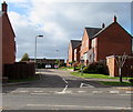
Whitchurch from a hot air balloon
An envigorating experience if only to think there is the thickness of a wicker basket beneath your feet and a big gas flame above your head.
Image: © Richard Hoare
Taken: 25 Jul 2005
0.11 miles
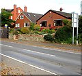
3
Queensway bungalows, Whitchurch, Shropshire
Viewed from the corner of the B5395 Sedgeford.
Originally, bungalow was used in English for a lightly-built house, with a veranda and one storey.
In current UK usage it is a convenient word for any one-storey dwelling.
Image: © Jaggery
Taken: 22 Oct 2015
0.12 miles
4
Warning sign - humps for half-a-mile ahead, Sedgeford, Whitchurch, Shropshire
The red-edged triangular sign is on the east side of the B5395 Sedgeford.
Image: © Jaggery
Taken: 22 Oct 2015
0.14 miles
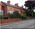
5
Sedgeford houses, Whitchurch, Shropshire
On the east side of the B5395 Sedgeford.
Image: © Jaggery
Taken: 22 Oct 2015
0.14 miles
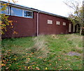
6
Former Whitchurch Ambulance Station, Shropshire
The Sedgeford side of the single-storey building on the corner of Queensway.
Viewed in October 2015 when a nearby For Sale board states
Development Opportunity (Subject to Planning Permission).
Planning Submitted for 6 Dwellings.
0.14 Hectares (0.36 acres).
Image: © Jaggery
Taken: 22 Oct 2015
0.14 miles
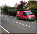
7
Royal Mail van, Sedgeford, Whitchurch, Shropshire
Viewed across the B5395 Sedgeford.
Image: © Jaggery
Taken: 22 Oct 2015
0.14 miles
8
Sedgeford houses, Whitchurch, Shropshire
Viewed across the B5395 Sedgeford.
Image: © Jaggery
Taken: 22 Oct 2015
0.14 miles
9
Ramp to Queensway bungalows, Whitchurch, Shropshire
From the corner of the B5395 Sedgeford.
Image: © Jaggery
Taken: 22 Oct 2015
0.14 miles
10
Dodington Close, Whitchurch (Shropshire)
Cul-de-sac on the west side of the B5395 Sedgeford.
Image: © Jaggery
Taken: 22 Oct 2015
0.15 miles


