1
Two and three storey buildings, Dodington, Whitchurch, Shropshire
Viewed across Dodington from the corner of Rosemary Lane.
Image: © Jaggery
Taken: 22 Oct 2015
0.01 miles
2
Bend in Rosemary Lane, Whitchurch, Shropshire
Rosemary Lane approaches the Dodington junction.
Image: © Jaggery
Taken: 22 Oct 2015
0.01 miles
3
Three-storey row of houses, Dodington, Whitchurch, Shropshire
Opposite the Rosemary Lane junction.
Image: © Jaggery
Taken: 22 Oct 2015
0.02 miles
4
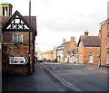
Turn right for Whitchurch town centre, Shropshire
The sign facing vehicles on Dodington points right towards Bridgewater Street.
Image: © Jaggery
Taken: 22 Oct 2015
0.02 miles
5
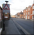
Warning sign - humps for 320 yards, Dodington, Whitchurch, Shropshire
The road is named Dodington. A nearby information board states that in Saxon times this part of Whitchurch was known as Dodtune - the town of Dodda's people. It was a separate township with its own manor and had grown up along the line of the Roman road built to link Viroconium (Wroxeter) to Deva (Chester). Dodtune became part of the town of Whitchurch after the Norman Conquest.
Image: © Jaggery
Taken: 22 Oct 2015
0.02 miles
6
Three-storey houses, Dodington, Whitchurch, Shropshire
Viewed across Dodington. The car is on the corner of Bridgewater Street.
Image: © Jaggery
Taken: 22 Oct 2015
0.02 miles
7
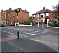
Zebra crossing, Dodington, Whitchurch, Shropshire
Across the B5476 Dodington.
Image: © Jaggery
Taken: 22 Oct 2015
0.03 miles
8
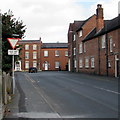
Give way 50 yds ahead, Rosemary Lane, Whitchurch, Shropshire
The sign faces Rosemary Lane on the approach to the Dodington junction.
Image: © Jaggery
Taken: 22 Oct 2015
0.04 miles
9
Houses on the east side of Dodington, Whitchurch, Shropshire
Viewed across the B5476 Dodington.
Image: © Jaggery
Taken: 22 Oct 2015
0.04 miles
10
Grade II listed 30-36 Dodington, Whitchurch, Shropshire
Row of four almshouses built in 1829, Grade II listed in 1951.The central lozenge shows
BUILT AND ENDOWED BY ELIZABETH LANGFORD IN THE YEAR MDCCCXXIX.
The raised scroll beneath shows DA GLORIAM DEO.
Image: © Jaggery
Taken: 22 Oct 2015
0.04 miles


