IMAGES TAKEN NEAR TO
Greenfields Gardens, SHREWSBURY, SY1 2RP
Introduction
This page details the photographs taken nearby to Greenfields Gardens, SY1 2RP by members of the Geograph project.
The Geograph project started in 2005 with the aim of publishing, organising and preserving representative images for every square kilometre of Great Britain, Ireland and the Isle of Man.

There are currently over 7.5m images from over14,400 individuals and you can help contribute to the project by visiting https://www.geograph.org.uk
Image Map
Images are licensed for reuse under creativecommons.org/licenses/by-sa/2.0
Notes
- Clicking on the map will re-center to the selected point.
- The higher the marker number, the further away the image location is from the centre of the postcode.
Image Listing (241 Images Found)
Images are licensed for reuse under creativecommons.org/licenses/by-sa/2.0
Image
Details
Distance
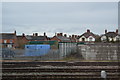
2
Railway south of Ellesmere Road bridge
There are currently three tracks passing beneath the bridge; old maps show there were once six, some of them serving sidings where there is now housing (left of photo).
Image: © Stephen Craven
Taken: 16 Oct 2022
0.05 miles
3
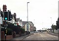
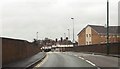
Ellesmere Road approaching railway bridge
Image: © John Firth
Taken: 13 Apr 2014
0.06 miles
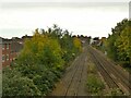
4
Railway north from Shrewsbury, looking to Ellesmere Road bridge
A long distance shot taken from the path called The Dana, above the station forecourt, with a view through Shrewsbury’s suburbs to farmland beyond.
Image: © David Martin
Taken: 14 Sep 2022
0.06 miles
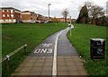
6
Muddy track towards Greenfields Gardens, Shrewsbury
Muddy on December 1st 2015, the track has been created by hundreds or
perhaps thousands of walkers taking the same shortcut across grass.
Image: © Jaggery
Taken: 1 Dec 2015
0.06 miles
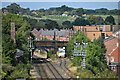
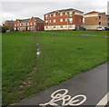
7
Footpath and cycle route towards Greenfields Gardens, Shrewsbury
From an industrial area on the west side of the A5191 Castle Foregate.
Image: © Jaggery
Taken: 1 Dec 2015
0.07 miles
8
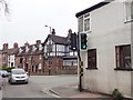
Junction of Coton Hill and Berwick Road, Shrewsbury
The Woodman Inn is at the junction
Image: © Eirian Evans
Taken: 7 Apr 2019
0.08 miles
9
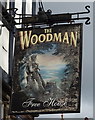
Sign for the Woodman Inn, Shrewsbury
See Image] for context.
Image: © JThomas
Taken: 14 Mar 2019
0.08 miles
10
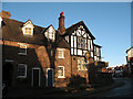
The Woodman, Coton Hill
One of three pubs within a few yards of each other (the others being the Royal Oak and the Bird in Hand)
Image: © Stephen Craven
Taken: 18 Nov 2008
0.08 miles