1
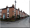
Corner of Queen Street and North Street, Shrewsbury
North Street viewed from Queen Street.
Image: © Jaggery
Taken: 31 May 2014
0.00 miles
2
All Saints Hall, Queen Street, Castlefields, Shrewsbury
Once a church hall for All Saints with St Michael's church, and now more of a community hall I think, holding yoga classes and Buddhist meditation classes I think.
Better do both hadn't I?
Image: © Jeremy Bolwell
Taken: 16 Nov 2021
0.01 miles
3
All Saints Hall, Shrewsbury
The Queen Street church hall is located 130 metres east of All Saints Parish Church http://www.geograph.org.uk/photo/4643767 in North Street.
Image: © Jaggery
Taken: 31 May 2014
0.01 miles
4
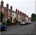
East along North Street, Shrewsbury
Houses on the north side of North Street, east of All Saints Parish Church. http://www.geograph.org.uk/photo/4643767
Image: © Jaggery
Taken: 31 May 2014
0.02 miles
5
Queen Street south of North Street, Shrewsbury
Houses on the east side of Queen Street viewed looking towards Burton Street.
Image: © Jaggery
Taken: 31 May 2014
0.03 miles
6
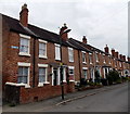
Part of North Street, Castlefields, Shrewsbury
A late Victorian terraced street in this central suburb.
Image: © Jeremy Bolwell
Taken: 6 Jun 2020
0.03 miles
7
Lane towards Dorset Farm, Shrewsbury
East from Queen Street.
Image: © Jaggery
Taken: 31 May 2014
0.04 miles
8
Queen Street houses, Shrewsbury
Houses on the east side of Queen Street. All Saints Hall http://www.geograph.org.uk/photo/4643862 is on the right.
Image: © Jaggery
Taken: 31 May 2014
0.04 miles
9
Burton Street
Looking along Burton Street from the junction with Sydney Avenue.
Image: © DS Pugh
Taken: 29 Jul 2018
0.04 miles
10
Along Burton Street
Looking along Burton Street in Shrewsbury.
Image: © DS Pugh
Taken: 29 Jul 2018
0.05 miles


