IMAGES TAKEN NEAR TO
Sherwood Gardens, Crewe Street, SHREWSBURY, SY1 2HN

Introduction

This page details the photographs taken nearby to Sherwood Gardens, Crewe Street, SY1 2HN by members of the Geograph project.

The Geograph project started in 2005 with the aim of publishing, organising and preserving representative images for every square kilometre of Great Britain, Ireland and the Isle of Man.

There are currently over 7.5m images from over14,400 individuals and you can help contribute to the project by visiting https://www.geograph.org.uk

Image Map


Images are licensed for reuse under creativecommons.org/licenses/by-sa/2.0
Notes
  • Clicking on the map will re-center to the selected point.
  • The higher the marker number, the further away the image location is from the centre of the postcode.

Image Listing (142 Images Found)

Images are licensed for reuse under creativecommons.org/licenses/by-sa/2.0
  • ...
Image
Details
Distance
1
Ordnance Survey Cut Mark
This OS cut mark can be found on the graveyard wall SE side of Crewe Street. It marks a point 60.484m above mean sea level.
Image: © Adrian Dust Taken: 3 Jul 2023
0.02 miles
2
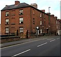
Ann's Hill, Shrewsbury
Viewed across the A5191 St Michael's Street. Ann's Hill is a terrace of 3-storey Georgian houses, now numbered 56-59 St Michael’s Street. The Shrewsbury Local History Society website states that they were built by John Simpson, and named after his second daughter, who was christened Marianne in 1793, but was known as Ann. Ann's Hill was built at the same time as the nearby Ditherington Flax Mill (opened in 1797), and it is thought to have been the original apprentice house for the factory.
Image: © Jaggery Taken: 16 Nov 2015
0.03 miles
3
OS benchmark - Castlefields, tower of St Michael's church
An OS cutmark at the base of the tower of the former church (now a Masonic Hall) on Crewe Street. It was originally levelled, probably in 1967 at 60.92m above Ordnance Datum Newlyn.
Image: © Richard Law Taken: 31 May 2018
0.04 miles
4
Former Church of St Michael, Shrewsbury
Now a Masonic hall. Built 1829 and Listed Grade II.
Image: © Chris Allen Taken: 3 Dec 2022
0.04 miles
5
The Malting
This is the first iron framed constructed building in the world and now under ownership of The English Heritage
Image: © Mr M Evison Taken: 2 Jan 2006
0.04 miles
6
Row of 3-storey houses, St Michael's Street, Shrewsbury
Arranged in groups of two houses, with the front doors side by side, between the windows of each house.
Image: © Jaggery Taken: 16 Nov 2015
0.05 miles
7
St Michael's Church, Shrewsbury
Now a Masonic Hall.
Image: © Chris Allen Taken: 3 Dec 2022
0.05 miles
8
Ordnance Survey Cut Mark
This OS cut mark can be found on the west angle of St Michael's Church. It marks a point 60.920m above mean sea level.
Image: © Adrian Dust Taken: 3 Jul 2023
0.05 miles
9
Beddow Close
Image: © Mr M Evison Taken: 7 Mar 2010
0.05 miles
10
St Michael's Clinic, Shrewsbury
This is a specialist dermatology clinic that caters to both the private sector and to NHS referrals.
Image: © Chris Allen Taken: 3 Dec 2022
0.05 miles
  • ...