1
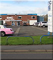
SMC music & audio superstore, Shrewsbury
Looking across the A5191 St Michael's Street past the boot of a pink stretch limo. http://www.geograph.org.uk/photo/4742806
Image: © Jaggery
Taken: 16 Nov 2015
0.01 miles
2
Salop Music Centre
Image: © Mr M Evison
Taken: 7 Mar 2010
0.02 miles
3
ARC car wash, Shrewsbury
Viewed across the A5191 St Michael's Street.
Image: © Jaggery
Taken: 16 Nov 2015
0.02 miles
4
Pink stretch limo in Castlefields, Shrewsbury
Viewed across the A5191 St Michael's Street.
Image: © Jaggery
Taken: 16 Nov 2015
0.03 miles
5
Bob Smith Carpets & Beds shop and van, Shrewsbury
Located in St Michael's Street in the Castlefields area of Shrewsbury.
Image: © Jaggery
Taken: 16 Nov 2015
0.03 miles
6
Derfald House, Shrewsbury
Flats viewed across Derfald Street from the corner of the A5191 St Michael's Street. The Walking Past website states that Derfald is derived from "deer fold" dating from the time when the land was part of Edward Elsmere's New Park.
Derfald House dates from 1832, originally the School of St Mary and St Michael. It was opposite a number of old terraces forming Oakley's Square, later known as Derfald Court, which is now the fire station site.
Image: © Jaggery
Taken: 16 Nov 2015
0.03 miles
7
Derfald House, Shrewsbury
Now flats, this was built in 1832 and was originally the School of St Mary and St Michael.
Image: © Chris Allen
Taken: 3 Dec 2022
0.03 miles
8
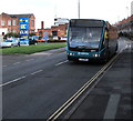
Arriva bus in Castlefields, Shrewsbury
Arriva Optare bus, fleet number 2993, is heading towards the town centre on the A5191 St Michael's Street.
ARC car wash http://www.geograph.org.uk/photo/4742803 is on the left.
Image: © Jaggery
Taken: 16 Nov 2015
0.04 miles
9
HSS Hire Shop, Shrewsbury
Tool hire and rental shop on the corner of St Michael's Street and Derfald Street.
Image: © Jaggery
Taken: 16 Nov 2015
0.04 miles
10
Remains of a crane, St Michael's Street, Shrewsbury
This is the manual winding mechanism of a crane that would once have had a wooden jib. I do not have any further history for this.
Image: © Chris Allen
Taken: 3 Dec 2022
0.04 miles


