IMAGES TAKEN NEAR TO
Whitemere, ELLESMERE, SY12 0HZ
Introduction
This page details the photographs taken nearby to SY12 0HZ by members of the Geograph project.
The Geograph project started in 2005 with the aim of publishing, organising and preserving representative images for every square kilometre of Great Britain, Ireland and the Isle of Man.

There are currently over 7.5m images from over14,400 individuals and you can help contribute to the project by visiting https://www.geograph.org.uk
Image Map
Images are licensed for reuse under creativecommons.org/licenses/by-sa/2.0
Notes
- Clicking on the map will re-center to the selected point.
- The higher the marker number, the further away the image location is from the centre of the postcode.
Image Listing (4 Images Found)
Images are licensed for reuse under creativecommons.org/licenses/by-sa/2.0
Image
Details
Distance
1
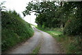
Towards Colemere Woods
A steep drive, looking promising but at the day's end too much.
Image: © Geoff Evans
Taken: 27 Aug 2007
0.08 miles
2
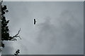
Bonus Buzzard
Just packing in for the day, losing the light, when the plaintive "Mew" of this buzzard was heard as it also came to roost, in the nearby tree.
Image: © Geoff Evans
Taken: 27 Aug 2007
0.10 miles
3
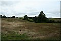
Pastoral Scene
Typical of the topography of the area of North Shropshire.
Image: © Geoff Evans
Taken: 27 Aug 2007
0.13 miles
4
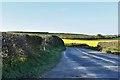
Colemere: A528 Cockshutt to Ellesmere Road
Image: © Michael Garlick
Taken: 30 Apr 2019
0.24 miles