IMAGES TAKEN NEAR TO
Chestnut Avenue, OSWESTRY, SY11 2QY
Introduction
This page details the photographs taken nearby to Chestnut Avenue, SY11 2QY by members of the Geograph project.
The Geograph project started in 2005 with the aim of publishing, organising and preserving representative images for every square kilometre of Great Britain, Ireland and the Isle of Man.

There are currently over 7.5m images from over14,400 individuals and you can help contribute to the project by visiting https://www.geograph.org.uk
Image Map (Loading...)


Getting Data...Please wait
Leaflet Map data © OpenStreetMap
Images are licensed for reuse under creativecommons.org/licenses/by-sa/2.0
Notes
- Clicking on the map will re-center to the selected point.
- The higher the marker number, the further away the image location is from the centre of the postcode.
Image Listing (13 Images Found)
Images are licensed for reuse under creativecommons.org/licenses/by-sa/2.0
Image
Details
Distance
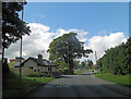
1
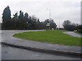
Shrewsbury Road from Fir Grove
Sycamore Drive curving on the right.
Image: © Colin Pyle
Taken: 21 Nov 2009
0.06 miles
2
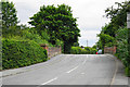
Shrewsbury Road crossing a defunct railway
The railway still has some rails and is crossed by the town's bypass.
Image: © Bill Boaden
Taken: 11 Jul 2015
0.08 miles
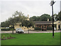
3
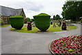
Entrance to Oswestry Cemetery
Are the shaped trees supposed to resemble urns?
Image: © Bill Boaden
Taken: 11 Jul 2015
0.10 miles
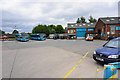
4
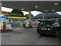
Petrol Station, Oswestry
On the B4579 Shrewsbury Road out of Oswestry.
Image: © Eirian Evans
Taken: 23 Sep 2007
0.10 miles
5
Shrewsbury Road between Oak Drive and Greystone Way
Image: © Stuart Logan
Taken: 19 Sep 2013
0.12 miles
7
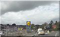
The new Lidl store Oswestry
The store used to be J.T.Hughes car dealer
Image: © John Firth
Taken: 12 Sep 2017
0.13 miles
9
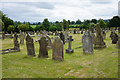
Oswestry Cemetery
Fields on the edge of the town can be seen, and there is a distant view of the Breidden Hills.
Image: © Bill Boaden
Taken: 11 Jul 2015
0.15 miles
10
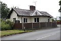
Old Toll House by the B4579, Gallowstree Bank, Oswestry
Toll House by the B4579, in the parish of Oswestry, Gallowstree Bank.
Demolished in 2015 when the supermarket was built - it was directly beneath the current car park entrance.
Shropshire HER.
HER Number (PRN): 30708 https://www.heritagegateway.org.uk/Gateway/Results_Single.aspx?uid=MSA33498&resourceID=1015
To be surveyed
Milestone Society National ID: SA.OSW07
Image: © Milestone Society
Taken: Unknown
0.17 miles