1
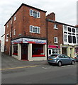
Beatrice Street Barbers in Oswestry
On the corner of Beatrice Street and Cambrian Place.
Image: © Jaggery
Taken: 15 Sep 2014
0.02 miles
2
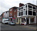
Jeanies Cafe in Oswestry
On the corner of Beatrice Street and Swan Lane.
Image: © Jaggery
Taken: 15 Sep 2014
0.02 miles
3
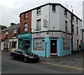
Lees takeaway in Oswestry
Chinese and English food takeaway in Beatrice Street, on the corner of Cambrian Place.
Image: © Jaggery
Taken: 15 Sep 2014
0.02 miles
4
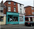
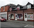
The Pincushion, Oswestry
The Pincushion at 67 Beatrice Street sells a range of British yarns including Shropshire Yarn spun from Shropshire sheep (Flock of Ages) and Blue Faced Leicester wool. The Pincushion also holds workshops (for all ages) in dressmaking, soft furnishings, toy making, spinning, knitting, crochet, re-upholstery etc.
Image: © Jaggery
Taken: 15 Sep 2014
0.02 miles
5
Ordnance Survey Flush Bracket G3033
This can be found on the wall of The Railway Inn in Oswestry.
For more detail see : http://www.bench-marks.org.uk/bm15018
Image: © Peter Wood
Taken: 8 Dec 2016
0.03 miles
6
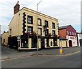
The Railway Tavern, Oswestry
On the corner of Beatrice Street and Swan Lane, facing Oswestry Bus Station.
The name sign hanging from a bracket on the first floor shows THE RAILWAY TAVERN.
The name over the entrance is RAILWAY.
Image: © Jaggery
Taken: 15 Sep 2014
0.03 miles
7
Ordnance Survey Flush Bracket (G3033)
This OS Flush Bracket can be found on the Railway Inn. It marks a point 125.341m above mean sea level.
Image: © Adrian Dust
Taken: 22 Sep 2018
0.03 miles
8
Albert Road Evangelical Church, Oswestry
Located near the southern (Beatrice Street) end of Albert Road.
Image: © Jaggery
Taken: 15 Sep 2014
0.03 miles
9
China Palace, Oswestry
Cantonese restaurant in Beatrice Street. The yellow building next door is The Railway Tavern. http://www.geograph.org.uk/photo/4169610
Image: © Jaggery
Taken: 15 Sep 2014
0.03 miles
10
Trisha's bridalwear shop in Oswestry
57-59 Beatrice Street.
Image: © Jaggery
Taken: 15 Sep 2014
0.03 miles


