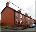
IMAGES TAKEN NEAR TO
Glanaber Terrace, OSWESTRY, SY10 7RH

Introduction

This page details the photographs taken nearby to Glanaber Terrace, SY10 7RH by members of the Geograph project.

The Geograph project started in 2005 with the aim of publishing, organising and preserving representative images for every square kilometre of Great Britain, Ireland and the Isle of Man.

There are currently over 7.5m images from over14,400 individuals and you can help contribute to the project by visiting https://www.geograph.org.uk

Image Map


Images are licensed for reuse under creativecommons.org/licenses/by-sa/2.0
Notes
  • Clicking on the map will re-center to the selected point.
  • The higher the marker number, the further away the image location is from the centre of the postcode.

Image Listing (70 Images Found)

Images are licensed for reuse under creativecommons.org/licenses/by-sa/2.0
  • ...
Image
Details
Distance
1
The Lodge, Weston Rhyn
Currently closed due to Covid 19 pandemic.
Image: © Richard Hoare Taken: 22 Feb 2021
0.00 miles
2
Glanaber Terrace, Weston Rhyn
A separately-named row of houses near the SE end of Bronygarth Road.
Image: © Jaggery Taken: 16 Oct 2014
0.00 miles
3
The Lodge inn at Weston Rhyn
The community at Weston Rhyn have their own website, at http://www.westonrhyn-online.co.uk/home.htm
Image: © Peter Craine Taken: 26 Aug 2006
0.01 miles
4
Part of Weston Rhyn village
Nice place.
Image: © Jeremy Bolwell Taken: 5 Apr 2015
0.01 miles
5
Junction of Bronygarth Road and High Street, Weston Rhyn
Image: © Humphrey Bolton Taken: 17 Aug 2014
0.01 miles
6
Weston Rhyn
Image: © Richard Webb Taken: 4 Apr 2013
0.02 miles
7
Weston Rhyn Parish Council offices
Shooting into the sun a form of corona appears around the roof.
Image: © Richard Hoare Taken: 22 Feb 2021
0.02 miles
8
War memorial, Weston Rhyn
Image: © Richard Hoare Taken: 22 Feb 2021
0.02 miles
9
The Lodge, Weston Rhyn at the crossroads
Complete with an old roadsign.
Image: © Richard Hoare Taken: 22 Feb 2021
0.02 miles
10
Weston Rhyn Stores
Between Bronygarth Road on the left and High Street on the right.
Image: © Jaggery Taken: 16 Oct 2014
0.02 miles
  • ...