1
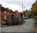
Cemetery at Weston Rhyn
Image: © Peter Craine
Taken: 26 Aug 2006
0.05 miles
2
A Free Churches Burial ground
A well maintained modern country cemetery.
Image: © John Haynes
Taken: 28 Apr 2013
0.06 miles
3
Parkfields, Weston Rhyn
A northwards continuation of High Street.
Image: © Jaggery
Taken: 16 Oct 2014
0.06 miles
4
Grade II listed turreted Sunday School, Weston Rhyn
On the corner of High Street and Quinta Crescent, the Sunday School
dates from 1882, built of Ruabon red brick. Grade II listed in 1987.
Image: © Jaggery
Taken: 16 Oct 2014
0.09 miles
5
High Street houses, Weston Rhyn
Near the northern end of High Street.
Image: © Jaggery
Taken: 16 Oct 2014
0.12 miles
6
Unusual building in Weston Rhyn
This is the Quinta Congregational Sunday School, built in 1882 by the local landowner, Thomas Barnes, who also built the Quinta Congregational Chapel up the road. Originally built as a day school and Sunday School, universal state education made it used as only a Sunday School, though there were other events held in it down through the years (Gardeners' Question Time many years ago). Changes in regulations and shortage of funds have reduced usage, but it is still used for the Sunday School of the Quinta Independent Evangelical Church (the newer name for the Quinta Congregational Church) which meets in the Quinta Congregational Chapel
Image: © Peter Craine
Taken: 26 Aug 2006
0.13 miles
7
Quinta Crescent, Weston Rhyn
Looking SW from the northern end of High Street.
Image: © Jaggery
Taken: 16 Oct 2014
0.13 miles
8
Quinta Crescent houses in Weston Rhyn
A sign shows Give Way 115 yards ahead (at crossroads).
Image: © Jaggery
Taken: 16 Oct 2014
0.16 miles
9
Pleasant View, Weston Rhyn
Cul-de-sac on the west side of High Street.
Image: © Jaggery
Taken: 16 Oct 2014
0.17 miles
10
Quinta Chapel in Weston Rhyn
Built as a Congregational Church in 1858, with later additions and alterations, it is now an Independent Evangelical church.
Image: © Eirian Evans
Taken: 28 Jun 2018
0.19 miles


