1
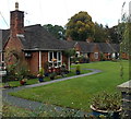
Quinta Meadows, Weston Rhyn
A row of 6 single-storey houses, originally almshouses
for poor females, on the west side of the Quinta Chapel. http://www.geograph.org.uk/photo/4245806
Image: © Jaggery
Taken: 16 Oct 2014
0.01 miles
2
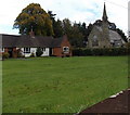
Houses and chapel, Weston Rhyn
The eastern end of Quinta Meadows houses http://www.geograph.org.uk/photo/4245911 and the Quinta Chapel. http://www.geograph.org.uk/photo/4245806
Image: © Jaggery
Taken: 16 Oct 2014
0.02 miles
3
The Quinta Chapel in Weston Rhyn
Viewed across Bronygarth Road, now (2014) an Independent Evangelical Church, built as a Congregational Church in 1858, with later additions and alterations. Grade II listed in 1987.
Image: © Jaggery
Taken: 16 Oct 2014
0.03 miles
4
Quinta Chapel in Weston Rhyn
Built as a Congregational Church in 1858, with later additions and alterations, it is now an Independent Evangelical church.
Image: © Eirian Evans
Taken: 28 Jun 2018
0.03 miles
5
Quinta Chapel lychgate, Weston Rhyn
Viewed across Bronygarth Road, at the southern entrance to the Quinta Chapel. http://www.geograph.org.uk/photo/4245806 Shaded by a tree, the lychgate was a shelter for a coffin until the clergyman's arrival for the burial, or pre-burial service.
Image: © Jaggery
Taken: 16 Oct 2014
0.04 miles
6
Quinta Crescent bench and grit box, Weston Rhyn
Viewed from crossroads. http://www.geograph.org.uk/photo/4245755
Image: © Jaggery
Taken: 16 Oct 2014
0.05 miles
7
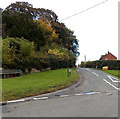
Crossroads in Weston Rhyn
Viewed along Quinta Crescent looking towards Bronygarth Road.
Image: © Jaggery
Taken: 16 Oct 2014
0.05 miles
8
Entrance to The Quinta
This is a Christian conference centre at Weston Rhyn and the HQ of 'Operation Mobilization', a mission agency.
Image: © John H Darch
Taken: 14 Oct 2020
0.06 miles
9
NW boundary of Weston Rhyn
The National Speed Limit on this side reduces to 30mph in Weston Rhyn, a village in NW Shropshire.
Image: © Jaggery
Taken: 16 Oct 2014
0.06 miles
10
End of the 30 zone in Weston Rhyn
The National Speed Limit signs are on the back of the Weston Rhyn boundary signs. http://www.geograph.org.uk/photo/4245927
Image: © Jaggery
Taken: 16 Oct 2014
0.06 miles


